Ipiullik Point Topo Map Online
Download Free Topo Map Sheet 087D06 at 1:50,000 scale
087D06 Ipiullik Point Topo Map
To view this map, mouse over the map preview on the right.
You can also download this topo map for free:
087D06 Ipiullik Point high-resolution topo map image.
Maps for the Ipiullik Point topo map sheet 087D06 at 1:50,000 scale are also available in these versions:
Ipiullik Point Surrounding Area Topo Maps
 |
 |
 |
 |
 |
 |
 |
 |
 |
 |
 |
 |
 |
 |
© Department of Natural Resources Canada. All rights reserved.
Ipiullik Point Gazetteer
The following places can be found on topographic map sheet 087D06 Ipiullik Point:
Ipiullik Point Topo Map: Bays
Falaise BaySimpson Bay
Ipiullik Point Topo Map: Capes
7 Miles PointIpiullik Point
Tugghittug Point
Wollaston Peninsula
Ipiullik Point Topo Map: Islands
Qikirtaarjuk IslandTugghittug Island
Uguhivig Island
Victoria Island
Ipiullik Point Topo Map: Mountains
Colvile Mountains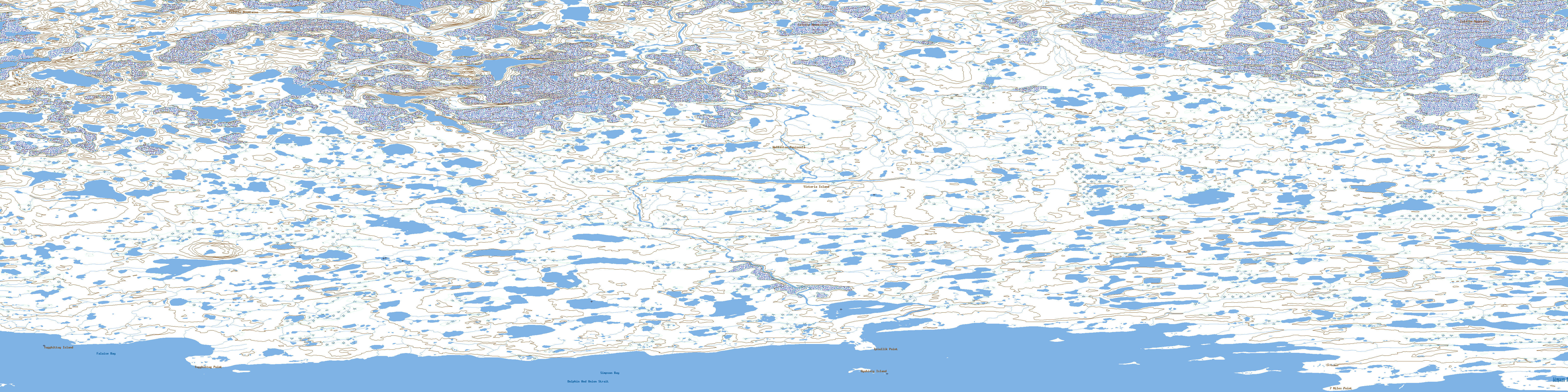
© Department of Natural Resources Canada. All rights reserved.
