Salmon Valley Topo Map Online
Download Free Topo Map Sheet 093J02 at 1:50,000 scale
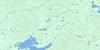
093J02 Salmon Valley Topo Map
To view this map, mouse over the map preview on the right.
You can also download this topo map for free:
093J02 Salmon Valley high-resolution topo map image.
Maps for the Salmon Valley topo map sheet 093J02 at 1:50,000 scale are also available in these versions:
Salmon Valley Surrounding Area Topo Maps
 |
 |
 |
 |
 |
 |
 |
 |
 |
 |
 |
 |
 |
 |
 |
 |
© Department of Natural Resources Canada. All rights reserved.
Salmon Valley Gazetteer
The following places can be found on topographic map sheet 093J02 Salmon Valley:
Salmon Valley Topo Map: Indian Reserves
Fort George (Shelley) Indian Reserve 2Réserve indienne Fort George (Shelley) 2
Salmon Valley Topo Map: Lakes
Alana LakeBaurle Lake
Burned Lake
Chief Lake
EM & K Lake
Ferguson Lake
Gunniza Lake
Haglund Lake
Larson Lake
Madden Lake
Martin Lake
Nazul Lake
Nukko Lake
Ramblers Lake
Rancheree Lake
Ruby Lake
Swamp Lake
The Horse Pond
Salmon Valley Topo Map: Mountains
Pilot MountainSalmon Valley Topo Map: Major municipal/district area - major agglomerations
Regional District of Fraser-Fort GeorgeSalmon Valley Topo Map: Plains
Interior PlateauNechako Plateau
Salmon Valley Topo Map: Rapids
Giscome RapidsSalmon Valley Topo Map: Rivers
Baden CreekEcho Creek
Emmet Creek
Fleuve Fraser
Fraser River
Garvin Creek
Hospital Creek
Jacura Creek
McMillan Creek
Nukko Creek
Pastor Creek
Recurve Creek
Rensted Creek
Salmon River
Tay Creek
Willow River
Wilson Creek
Wright Creek
Salmon Valley Topo Map: Unincorporated areas
Chief LakeNukko Lake
Quaw
Salmon Valley
Salmon Valley
Shelley
Tay
© Department of Natural Resources Canada. All rights reserved.
093J Related Maps:
093J Mcleod Lake093J01 Giscome
093J02 Salmon Valley
093J03 Saxton Lake
093J04 Knight Creek
093J05 Great Beaver Lake
093J06 Bugle Lake
093J07 Summit Lake
093J08 Averil Lake
093J09 Hominka River
093J10 Tacheeda Lakes
093J11 Weedon Lake
093J12 Carrier Lake
093J13 Salmon Lake
093J14 Carp Lake
093J15 Firth Lake
093J16 Anzac River
