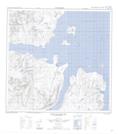
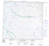
Maps showing Parc national du Canada des Monts-Torngat, Newfoundland and Labrador
Parc national du Canada des Monts-Torngat is a Conservation area located in Newfoundland and Labrador.
- Latitude: 59° 26' 9'' North (decimal: 59.4358)
- Longitude: 63° 41' 47'' West (decimal: -63.6964)
- Topography Feature Category: Conservation area
- Geographical Feature: Parc national
- Canadian Province/Territory: Newfoundland and Labrador
- Atlas of Canada Locator Map: Parc national du Canada des Monts-Torngat
- GPS Coordinate Locator Map: Parc national du Canada des Monts-Torngat Lat/Long
Parc national du Canada des Monts-Torngat NTS Map Sheets