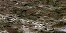
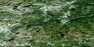
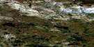
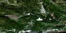
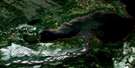
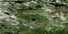
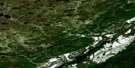
North West River Satellite Image Map
Download Free Aerial Photo 013F09 at 1:50,000 scale
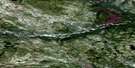
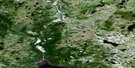
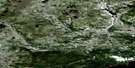
North West River Satellite Imagery
To view this satellite map, mouse over the air photo on the right.
You can also download this satellite image map for free:
013F09 North West River high-resolution satellite image map.
Maps for the North West River aerial map sheet 013F09 at 1:50,000 scale are also available in these versions:
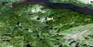
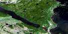
North West River Surrounding Area Aerial Photo Maps
 |
 |
 |
 |
 |
 |
 |
 |
 |
 |
 |
 |
 |
 |
 |
 |
© Department of Natural Resources Canada. All rights reserved.
North West River Gazetteer
The following places can be found on satellite image map 013F09 North West River:
North West River Satellite Image: Bays
Hamilton InletSebaskachu Bay
Sebaskachu Cove
The Bight
North West River Satellite Image: Capes
Bottle PointCape Caribou
Cotters Point
Montagnais Point
North West Point
Paddon Point
Ten Mile Point
North West River Satellite Image: Indian Reserves
Sheshatshiu 3North West River Satellite Image: Islands
Ambrose IslandBakeapple Islands
Butter Island
Dog Island
Edward Islands
Handy Islands
John Bull Island
Little Dog Island
Montagnais Islands
Sebaskachu Island
Thistle Island
Tickle Island
Upper Islands
Woody Islands
North West River Satellite Image: Lakes
Grand LakeLake Melville
Little Lake
North West River Satellite Image: Rapids
The RapidsNorth West River Satellite Image: Rivers
Cape Caribou RiverNorth West River
North West River Satellite Image: Shoals
Michelin ShoalMontagnais Shoal
North West River Satellite Image: Towns
North West RiverNorth West River Satellite Image: Unincorporated areas
SheshatsheitsSheshatshiu

© Department of Natural Resources Canada. All rights reserved.
013F Related Maps:
013F Goose Bay013F01 Traverspine River
013F02 Mckenzie River
013F03 Pinus River
013F04 No Title
013F05 No Title
013F06 No Title
013F07 Goose River
013F08 Goose Bay
013F09 North West River
013F10 Cape Caribou River
013F11 No Title
013F12 Mountaineer Lakes
013F13 No Title
013F14 Mount Sawyer
013F15 Mount Elizabeth
013F16 Mokami Hill
