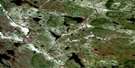
Churchill Falls Satellite Image Map
Download Free Aerial Photo 023H09 at 1:50,000 scale
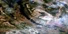
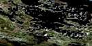
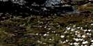
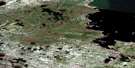
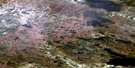
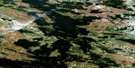
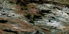
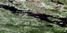
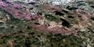
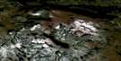
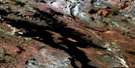
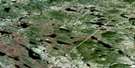
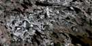
Churchill Falls Satellite Imagery
To view this satellite map, mouse over the air photo on the right.
You can also download this satellite image map for free:
023H09 Churchill Falls high-resolution satellite image map.
Maps for the Churchill Falls aerial map sheet 023H09 at 1:50,000 scale are also available in these versions:
Churchill Falls Surrounding Area Aerial Photo Maps
 |
 |
 |
 |
 |
 |
 |
 |
 |
 |
 |
 |
 |
 |
 |
 |
© Department of Natural Resources Canada. All rights reserved.
Churchill Falls Gazetteer
The following places can be found on satellite image map 023H09 Churchill Falls:
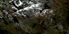
Churchill Falls Satellite Image: Falls
Churchill FallsGrand Falls
Michelin Falls
Thomas Falls
Whitefish Falls
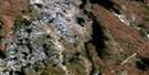
Churchill Falls Satellite Image: Lakes
Burnt LakeDiver Pond
Fore and Aft Pond
Gull Lake
Humbug Lake
Jacopie Lake
Lemon Lake
Logan Lake
Lookout Lake
Mount Hyde Lake
Notleys Pond
Whitefish Lake
Churchill Falls Satellite Image: Mountains
Lookout MountainLouis Ridge
Mount Hyde
Churchill Falls Satellite Image: Rapids
Barrier RapidsDisaster Rapids
Louie Rapids
Powell Rapids
Churchill Falls Satellite Image: Rivers
BonnellCreekChurchill River
Fleuve Churchill
Hamilton River
Mahers Brook
Portage River
Unknown River
Valley River
Churchill Falls Satellite Image: Unincorporated areas
Churchill FallsChurchill Falls Satellite Image: Valleys
Bowdoin Canyon
© Department of Natural Resources Canada. All rights reserved.
023H Related Maps:
023H Ossokmanuan Reservoir023H01 Chaulk Lake
023H02 Panchia Lake
023H03 Riviere Aux Poissons
023H04 No Title
023H05 Cissy Lake
023H06 Ossok Mountain
023H07 Baikie Lake
023H08 No Title
023H09 Churchill Falls
023H10 Raft River
023H11 Way Bay
023H12 Colville Lake
023H13 Sims Lake
023H14 Sandgrit Peak
023H15 No Title
023H16 Hook Bay
