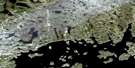
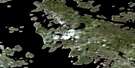
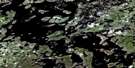
Lac Sorelet Satellite Image Map
Download Free Aerial Photo 023K12 at 1:50,000 scale
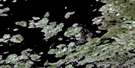
Lac Sorelet Satellite Imagery
To view this satellite map, mouse over the air photo on the right.
You can also download this satellite image map for free:
023K12 Lac Sorelet high-resolution satellite image map.
Maps for the Lac Sorelet aerial map sheet 023K12 at 1:50,000 scale are also available in these versions:
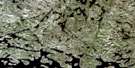
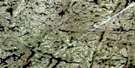
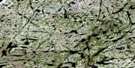
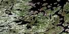
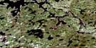
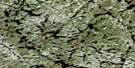
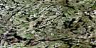
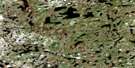
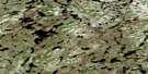
Lac Sorelet Surrounding Area Aerial Photo Maps
 |
 |
 |
 |
 |
 |
 |
 |
 |
 |
 |
 |
 |
 |
 |
 |
© Department of Natural Resources Canada. All rights reserved.
Lac Sorelet Gazetteer
The following places can be found on satellite image map 023K12 Lac Sorelet:
Lac Sorelet Satellite Image: Capes
Le Point de MireLac Sorelet Satellite Image: Islands
La Coquille ReferméeLa Failloise
La Malebête
La Mémoire de l'Eau
La Pelure de Ciel
La Petite Extrace
La Pierre Nue
La Porte du Songe
La Vie à Rebours
Le Haut des Limbes
Le Jardin au Bout du Monde
Le Nid du Silence
Le Poids des Ombres
Le Soleil des Gouffres
Le Vieux-Chagrin
Lac Sorelet Satellite Image: Lakes
Lac ArchinardLac Bellin
Lac Chamer
Lac Delorme
Lac Dubail
Lac Le Maistre
Lac Lemaître
Lac Renaudin
Lac Ruffey
Lac Sorelet
Réservoir de Caniapiscau

© Department of Natural Resources Canada. All rights reserved.
023K Related Maps:
023K Caniapiscau023K01 Lac Longrais
023K02 Lac Malapart
023K03 Lac Pierron
023K04
023K05 Lac Salvert
023K06 Lac Lantagnac
023K07 Lac Rousson
023K08 Lac Delornieu
023K09 Lac Bessieres
023K10 Lac Fauques
023K11 Lac Presles
023K12 Lac Sorelet
023K13 Lac Pau
023K14 Lac Lagny
023K15 Lac Costebelle
023K16 Lac Lachaussee
