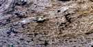
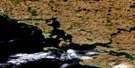
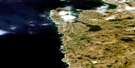
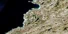
Lac Carye Satellite Image Map
Download Free Aerial Photo 035F03 at 1:50,000 scale
Lac Carye Satellite Imagery
To view this satellite map, mouse over the air photo on the right.
You can also download this satellite image map for free:
035F03 Lac Carye high-resolution satellite image map.
Maps for the Lac Carye aerial map sheet 035F03 at 1:50,000 scale are also available in these versions:
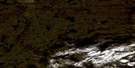
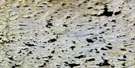
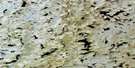
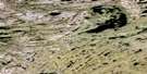
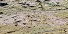
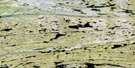
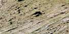
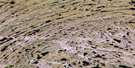
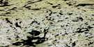
Lac Carye Surrounding Area Aerial Photo Maps
 |
 |
 |
 |
 |
 |
 |
 |
 |
 |
 |
 |
 |
 |
 |
 |
© Department of Natural Resources Canada. All rights reserved.
Lac Carye Gazetteer
The following places can be found on satellite image map 035F03 Lac Carye:
Lac Carye Satellite Image: Lakes
Lac CaryeLac Lahaye
Lac Qaliq
Lac Qaqqajuup Tasingata Qamaninga
Lac Qarqajuup Tasinga
Lac Qaumajulik
Lac Qaummaajuulik
Qaqqajuup Tasinga
Qarqajuup Tasinga
Lac Carye Satellite Image: Mountains
Cape Smith RangeColline Qaqqaajuk
Collines Naammait Siqinirsiit
Monts d'Youville
Monts D'Youville
Monts Qimiit
Lac Carye Satellite Image: Rivers
Ijaittuit KuungaIjaituit Kuungat
Qaumajuliup Kuunga
Qulliup Kuunga
Rivière Chukotat
Rivière Deguise
Rivière Delaize
Rivière Iktotat
Rivière Illukotat

© Department of Natural Resources Canada. All rights reserved.
035F Related Maps:
035F Kovik Bay035F01E Lac Juet
035F01W Lac Juet
035F02E Lac Vigneau
035F02W Lac Vigneau
035F03E Lac Carye
035F03W Lac Carye
035F04E Kettlestone Bay
035F04W Kettlestone Bay
035F05E Pointe Bernier
035F05W Pointe Bernier
035F06E Lac Lanyan
035F06W Lac Lanyan
035F07E Lac Begin
035F07W Lac Begin
035F08E Lac Hubert
035F08W Lac Hubert
035F09 Colline Talluq
035F10 Lac Bilson
035F11 Lac Atirtusiurvik
035F12 Kovik Bay
035F13 Riviere Frichet
035F14 Riviere Durouvray
035F15 Riviere Derville
035F16 Lac Amarurtuuq
