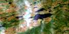
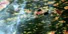
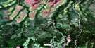
Smoky Falls Satellite Image Map
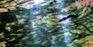
Download Free Aerial Photo 042J01 at 1:50,000 scale
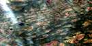
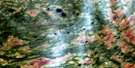
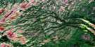
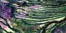
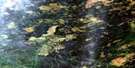
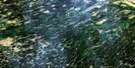
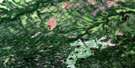
Smoky Falls Satellite Imagery
To view this satellite map, mouse over the air photo on the right.
You can also download this satellite image map for free:
042J01 Smoky Falls high-resolution satellite image map.
Maps for the Smoky Falls aerial map sheet 042J01 at 1:50,000 scale are also available in these versions:
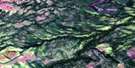
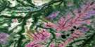
Smoky Falls Surrounding Area Aerial Photo Maps
 |
 |
 |
 |
 |
 |
 |
 |
 |
 |
 |
 |
 |
 |
 |
 |
© Department of Natural Resources Canada. All rights reserved.
Smoky Falls Gazetteer
The following places can be found on satellite image map 042J01 Smoky Falls:
Smoky Falls Satellite Image: Falls
Breakneck FallsChristopher Falls
Mareva Falls
Smoky Falls
Smoky Falls Satellite Image: Geographical areas
AcresBradley
Cockshutt
Emerson
Hambly
Haney
Harmon
Hecla
Kipling
McCausland
Sanborn
Wright
Smoky Falls Satellite Image: Conservation areas
Adam Creek Provincial Nature ReserveMattagami River Beach and Aeolian Deposit Provincial Park
Smoky Falls Satellite Image: Rapids
Grand RapidsLittle Long Rapids
Long Rapids
Smoky Falls Satellite Image: Rivers
Adam CreekBoyle Creek
Bradley Creek
Cockshutt Creek
Friday Creek
Mattagami River
Mowbray Creek
Opasatika River
Opazatika River
Rivière Mattagami
Rivière Opasatika
Trout Creek
Smoky Falls Satellite Image: River features
Great BendSmoky Falls Satellite Image: Unincorporated areas
Little Long RapidsSmoky Falls

© Department of Natural Resources Canada. All rights reserved.
042J Related Maps:
042J Smoky Falls042J01 Smoky Falls
042J02 Friday Creek
042J03 Thunder House Falls
042J04 Keown Lake
042J05 Serinack Lake
042J06 Martison Lake
042J07 Soweska River
042J08 Wawa Lakes
042J09 Mccuaig Creek
042J10 Schlievert Lakes
042J11 Crawford Lake
042J12 Moir Lake
042J13 Pledger Lake
042J14 Skene Lake
042J15 Lejambe Creek
042J16 Lawry Creek
