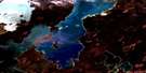
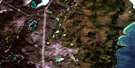
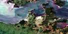
Mcleod Island Satellite Image Map
Download Free Aerial Photo 063G16 at 1:50,000 scale
Mcleod Island Satellite Imagery
To view this satellite map, mouse over the air photo on the right.
You can also download this satellite image map for free:
063G16 Mcleod Island high-resolution satellite image map.
Maps for the Mcleod Island aerial map sheet 063G16 at 1:50,000 scale are also available in these versions:
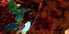
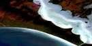
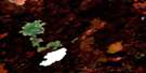
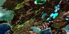
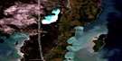
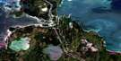
Mcleod Island Surrounding Area Aerial Photo Maps
 |
 |
 |
 |
 |
 |
 |
|
 |
 |
||
 |
 |
 |
© Department of Natural Resources Canada. All rights reserved.
Mcleod Island Gazetteer
The following places can be found on satellite image map 063G16 Mcleod Island:
Mcleod Island Satellite Image: Capes
Dennison PointErmine Point
Martin Point
Paupanekis Point
Peat Point
Sandy Bar Point
Weasel Point
Mcleod Island Satellite Image: Channels
Nelson River (West Channel)Two Mile Channel
Mcleod Island Satellite Image: Islands
Flett IslandJackfish Island
Langlois Islands
Malcolms Landing
McLeod Island
Ross Island
Whitefish Islands
Mcleod Island Satellite Image: Lakes
Lac WinnipegLake Winnipeg
Little Playgreen Lake
Playgreen Lake
Mcleod Island Satellite Image: Rivers
Fleuve NelsonKiskittogisu River
Little Sepastak Channel
Nelson River
Sepastak Channel

© Department of Natural Resources Canada. All rights reserved.
