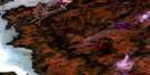
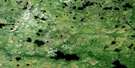
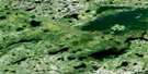
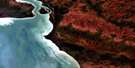
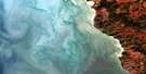
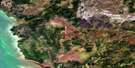
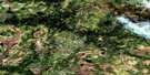
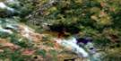
Warren Landing Satellite Image Map
Download Free Aerial Photo 063H12 at 1:50,000 scale
Warren Landing Satellite Imagery
To view this satellite map, mouse over the air photo on the right.
You can also download this satellite image map for free:
063H12 Warren Landing high-resolution satellite image map.
Maps for the Warren Landing aerial map sheet 063H12 at 1:50,000 scale are also available in these versions:
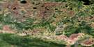
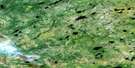
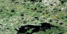
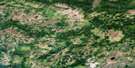
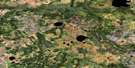
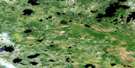
Warren Landing Surrounding Area Aerial Photo Maps
 |
 |
 |
 |
 |
 |
 |
 |
 |
 |
 |
 |
 |
 |
 |
 |
© Department of Natural Resources Canada. All rights reserved.
Warren Landing Gazetteer
The following places can be found on satellite image map 063H12 Warren Landing:
Warren Landing Satellite Image: Capes
Big Mossy PointDuck Point
Evans Point
Flag Point
Little Mossy Point
Montreal Point
Simpson Point
Warren Landing Satellite Image: Channels
Two Mile ChannelWarren Landing Satellite Image: Islands
Little Birch IslandPurvis Island
Wuskwi Island
Warren Landing Satellite Image: Lakes
Lac WinnipegLake Winnipeg
Playgreen Lake
Warren Landing Satellite Image: Rapids
Kawakitchewasik RapidsWarren Landing Satellite Image: Rivers
Back ChannelFirst Channel
Fleuve Nelson
Gunisao River
Middle Channel
Nelson River
Nupukawpiskaw Creek
Oscar Creek
Peewee Creek
Warren Landing Satellite Image: Unincorporated areas
Warren Landing
© Department of Natural Resources Canada. All rights reserved.
063H Related Maps:
063H Norway House063H01 Makatesibi Lake
063H02 Zayets Creek
063H03 Mukutawa River
063H04 Birdnest Point
063H05 Belanger Point
063H06 Anderson Falls
063H07 Okeskimunisew Lake
063H08 Bennett Lake
063H09 Gunisao Lake
063H10 Wechaki Lake
063H11 Ininiwekun Rapids
063H12 Warren Landing
063H13 Norway House
063H14 Costes Lake
063H15 Washahigan Lake
063H16 Beach Lake
