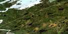
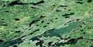
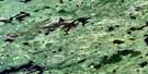
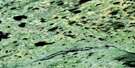
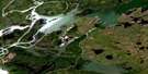
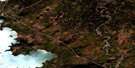
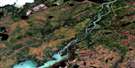
Robinson Lake Satellite Image Map
Download Free Aerial Photo 063I08 at 1:50,000 scale
Robinson Lake Satellite Imagery
To view this satellite map, mouse over the air photo on the right.
You can also download this satellite image map for free:
063I08 Robinson Lake high-resolution satellite image map.
Maps for the Robinson Lake aerial map sheet 063I08 at 1:50,000 scale are also available in these versions:
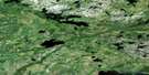
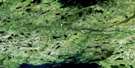
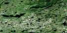
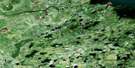
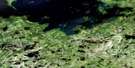
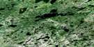
Robinson Lake Surrounding Area Aerial Photo Maps
 |
 |
 |
 |
 |
 |
 |
 |
 |
 |
 |
 |
 |
 |
 |
 |
© Department of Natural Resources Canada. All rights reserved.
Robinson Lake Gazetteer
The following places can be found on satellite image map 063I08 Robinson Lake:
Robinson Lake Satellite Image: Bays
Bradley BayRobinson Lake Satellite Image: Capes
Edwards PointRobinson Lake Satellite Image: Falls
Robinson FallsRobinson Lake Satellite Image: Islands
Michie IslandRobinson Lake Satellite Image: Lakes
Ferland LakeHarold Wilson Lake
Hodgins Lake
Logan Lake
Max Lake
Robinson Lake
Selby Henderson Lake
Tkachuk Lake
Robinson Lake Satellite Image: Mountains
Black EskerRobinson Lake Satellite Image: Rapids
Ohoomisewe RapidsOskatukaw Rapids
Robinson Lake Satellite Image: Rivers
Hayes RiverLawford River
Robinson Lake Satellite Image: Road features
Robinson Portage
© Department of Natural Resources Canada. All rights reserved.
063I Related Maps:
063I Cross Lake063I01 Little Bolton Lake
063I02 Molson River
063I03 Paimusk Creek
063I04 Pine Creek
063I05 Sugar Falls
063I06 Butterfly Lake
063I07 Joyal Lake
063I08 Robinson Lake
063I09 Andronyk Lake
063I10 Rurak Lake
063I11 Target Lake
063I12 Cross Lake
063I13 Hill Rapids
063I14 White Rabbit Lake
063I15 Bjornson Lake
063I16 Dubinsky Lake
