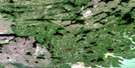
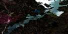
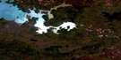
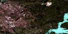
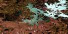
Pemichigamau Lake Satellite Image Map
Download Free Aerial Photo 064B05 at 1:50,000 scale
Pemichigamau Lake Satellite Imagery
To view this satellite map, mouse over the air photo on the right.
You can also download this satellite image map for free:
064B05 Pemichigamau Lake high-resolution satellite image map.
Maps for the Pemichigamau Lake aerial map sheet 064B05 at 1:50,000 scale are also available in these versions:
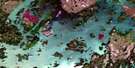
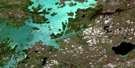
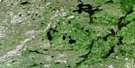
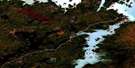
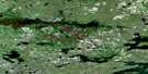
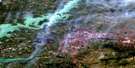
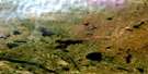
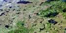
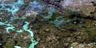
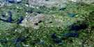
Pemichigamau Lake Surrounding Area Aerial Photo Maps
 |
 |
 |
 |
 |
 |
 |
 |
 |
 |
 |
 |
 |
 |
 |
 |
© Department of Natural Resources Canada. All rights reserved.
Pemichigamau Lake Gazetteer
The following places can be found on satellite image map 064B05 Pemichigamau Lake:
Pemichigamau Lake Satellite Image: Capes
Skwark PointPemichigamau Lake Satellite Image: Islands
Meakin IslandPemichigamau Lake Satellite Image: Lakes
Alto LakeBrehaut Lake
Buzz Horne Lake
Crater Lake
Cullen Lake
Darrol Lake
Doran Lake
Esker Lake
Karsakuwigamak Lake
Nabozniak Lake
Pemichigamau Lake
Pontius Lake
Ruttan Lake
Wess Lake
Pemichigamau Lake Satellite Image: Mountains
Roberts HillThompson Hill
Pemichigamau Lake Satellite Image: Rapids
Leaf RapidsPemichigamau Lake Satellite Image: Rivers
Churchill RiverMurray Creek
Rat River
Rivière Churchill
Vermilion River
White Creek
Pemichigamau Lake Satellite Image: Towns
Leaf RapidsPemichigamau Lake Satellite Image: Unincorporated areas
Ruttan Mine
© Department of Natural Resources Canada. All rights reserved.
064B Related Maps:
064B Uhlman Lake064B01 Harding Lake
064B02 Leftrook Lake
064B03 Mynarski Lakes
064B04 Goodwin Lake
064B05 Pemichigamau Lake
064B06 Earp Lake
064B07 Livingston Lake
064B08 Barnes Lake
064B09 Broughton Lake
064B10 Swan Bay
064B11 Issett Lake
064B12 Opachuanau Lake
064B13 Fraser Lake
064B14 Lemay Island
064B15 Cousins Lake
064B16 Chapman Lake
