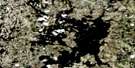
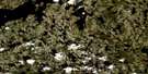
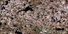
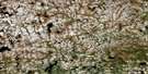
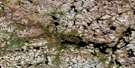
Adam Creek Satellite Image Map
Download Free Aerial Photo 064P10 at 1:50,000 scale
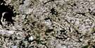
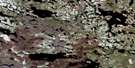
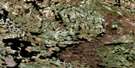
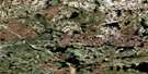
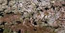
Adam Creek Satellite Imagery
To view this satellite map, mouse over the air photo on the right.
You can also download this satellite image map for free:
064P10 Adam Creek high-resolution satellite image map.
Maps for the Adam Creek aerial map sheet 064P10 at 1:50,000 scale are also available in these versions:
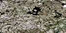
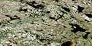
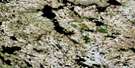
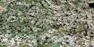
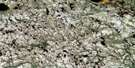
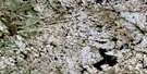
Adam Creek Surrounding Area Aerial Photo Maps
 |
 |
 |
 |
 |
 |
 |
 |
 |
 |
 |
 |
 |
 |
 |
 |
© Department of Natural Resources Canada. All rights reserved.
Adam Creek Gazetteer
The following places can be found on satellite image map 064P10 Adam Creek:
Adam Creek Satellite Image: Lakes
Baskerville LakeChown Lake
Desilets Lake
Essenberg Lake
Essenburg Lake
Gamsby Lake
Halperin Lake
Kitchen Lake
MacRovic Lake
Petrie Lake
Rempel Lake
Rink Lake
Round Sand Lake
Shusterove Lake
Talocka Lake
Towsley Lake
Adam Creek Satellite Image: Conservation areas
Caribou River Park ReserveAdam Creek Satellite Image: Rapids
Armstrong RapidsGreen Rapids
Hay Rapids
McRae Rapids
Ritchie Rapids
Adam Creek Satellite Image: Rivers
Adam CreekCameron River
Caribou River
Gordon River

© Department of Natural Resources Canada. All rights reserved.
064P Related Maps:
064P Nejanilini Lake064P01 Hebner Lake
064P02 Kesselman Lake
064P03 Sellar Lake
064P04 Macleod Lake
064P05 Little Duck Lake
064P06 Fallis Lake
064P07 Wallbridge Lake
064P08 Caribou Lake
064P09 Kellas Lake
064P10 Adam Creek
064P11 Abbott Lake
064P12 Hollowrock Island
064P13 Wakefield Lake
064P14 Commonwealth Lake
064P15 Vickery Lake
064P16 Nabel Lake
