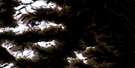
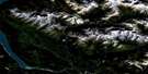
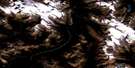
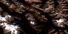
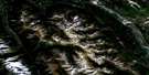
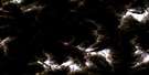
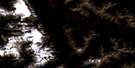
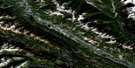
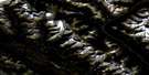
Mcmurdo Satellite Image Map
Download Free Aerial Photo 082N02 at 1:50,000 scale
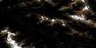
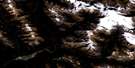
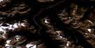
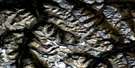
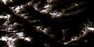
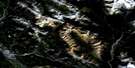
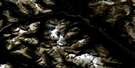
Mcmurdo Satellite Imagery
To view this satellite map, mouse over the air photo on the right.
You can also download this satellite image map for free:
082N02 Mcmurdo high-resolution satellite image map.
Maps for the Mcmurdo aerial map sheet 082N02 at 1:50,000 scale are also available in these versions:
Mcmurdo Surrounding Area Aerial Photo Maps
 |
 |
 |
 |
 |
 |
 |
 |
 |
 |
 |
 |
 |
 |
 |
 |
© Department of Natural Resources Canada. All rights reserved.
Mcmurdo Gazetteer
The following places can be found on satellite image map 082N02 Mcmurdo:
Mcmurdo Satellite Image: Channels
Back ChannelBaldy Channel
Hogranch Channel
Mcmurdo Satellite Image: Falls
Wapta FallsMcmurdo Satellite Image: Glaciers
Hanbury GlacierMcmurdo Satellite Image: Lakes
Hobo LakeLoon Lake
Nixon Lake
Redcliff Lake
Rocky Point Lake
Summit Lake
Three Island Lake
Whiskey Lake
Wilbur Lake
Mcmurdo Satellite Image: Mountains
Beaverfoot RangeButwell Peak
Cairn Mountain
Chancellor Peak
Columbia Mountains
Coral Mountain
Dogtooth Range
Kapristo Mountain
Kootenay Ranges
Montagnes Rocheuses
Ottertail Range
Purcell Mountains
Rocky Mountains
Spillimacheen Range
Tower Peak
Mcmurdo Satellite Image: Major municipal/district area - major agglomerations
Columbia-Shuswap Regional DistrictRegional District of Kootenay-Boundary
Mcmurdo Satellite Image: Conservation areas
Parc national du Canada YohoYoho National Park of Canada
Mcmurdo Satellite Image: Rivers
Bayview CreekBeard Creek
Beaverfoot River
Bicarbonate Creek
Birchlands Creek
Bobbie Burns Creek
Canyon Creek
Carbonate Creek
Clawson Creek
Columbia River
De Grazie Creek
Fleuve Columbia
Fraser Creek
Hobo Creek
Hobo Creek
Hogget Creek
Hogranch Creek
Hoodoo Creek
Horse Creek
Johnson Draw Creek
Kicking Horse River
Malachite Creek
Mallard Creek
Manitoba Creek
McBeath Creek
McKeeman Creek
Nelson Creek
Pagliaro Creek
Quinn Creek
Spillimacheen River
Steep Creek
Stony Creek
Tallis Creek
Tallon Creek
Twelve Mile Creek
Twin Creek
Vowell Creek
Wiedenman Creek
Mcmurdo Satellite Image: Unincorporated areas
CarbonateCastledale
Horse Creek
Leanchoil
McMurdo
Nicholson
Parson
Seeney
Mcmurdo Satellite Image: Valleys
Hoodoo ValleyRocky Mountain Trench

© Department of Natural Resources Canada. All rights reserved.
082N Related Maps:
082N Golden082N01 Mount Goodsir
082N02 Mcmurdo
082N03 Mount Wheeler
082N04 Illecillewaet
082N05 Glacier
082N06 Blaeberry
082N07 Golden
082N08 Lake Louise
082N09 Hector Lake
082N10 Blaeberry River
082N11 Bluewater Creek
082N12 Mount Sir Sandford
082N13 Sullivan River
082N14 Rostrum Peak
082N15 Mistaya Lake
082N16 Siffleur River
