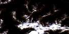
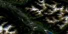
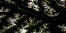
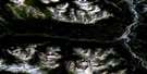
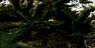
Azure River Satellite Image Map
Download Free Aerial Photo 083D12 at 1:50,000 scale
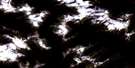
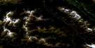
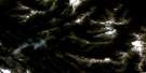
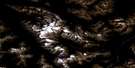
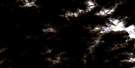
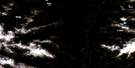
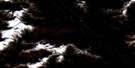
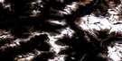
Azure River Satellite Imagery
To view this satellite map, mouse over the air photo on the right.
You can also download this satellite image map for free:
083D12 Azure River high-resolution satellite image map.
Maps for the Azure River aerial map sheet 083D12 at 1:50,000 scale are also available in these versions:
Azure River Surrounding Area Aerial Photo Maps
 |
 |
 |
 |
 |
 |
 |
 |
 |
 |
 |
 |
 |
 |
 |
 |
© Department of Natural Resources Canada. All rights reserved.
Azure River Gazetteer
The following places can be found on satellite image map 083D12 Azure River:
Azure River Satellite Image: Falls
Black Nun FallsBraithwaite Falls
Azure River Satellite Image: Glaciers
Blackstone GlacierBraithwaite Glacier
Braithwaite Icefield
Chamberlin Glacier
David Glacier
North Canoe Glacier
Raush Glacier
South Canoe Glacier
Thompson Glacier
Zillmer Glacier
Azure River Satellite Image: Lakes
McAndrew LakeZero Lake
Azure River Satellite Image: Mountains
Cariboo MountainsChamberlin Peak
Chilkst Peaks
Columbia Mountains
Mount Carpé
Mount Sir John Thompson
Mount Withers
Mount Zillmer
Premier Range
Trigon Mountain
Azure River Satellite Image: Major municipal/district area - major agglomerations
Cariboo Regional DistrictRegional District of Fraser-Fort George
Azure River Satellite Image: Conservation areas
Wellesley Gray Recreation AreaWells Gray Park
Wells Gray Recreation Area
Azure River Satellite Image: Rivers
Argyle CreekAzure River
Blackstone Creek
Bois Grenier Creek
Braithwaite Creek
Davehenry Creek
Davis Creek
East Creek
Ella Frye Creek
Erethizon Creek
Fred Wells Creek
Hobson Creek
Knutson Creek
Lebher Creek
McAndrew Creek
North Thompson River
Pleasant Creek
Raush River
St. Julien Creek
Stormking Creek
Warcolt Creek
Zillmer Creek

© Department of Natural Resources Canada. All rights reserved.
083D Related Maps:
083D Canoe River083D01 Wood Arm
083D02 Nagle Creek
083D03 Blue River
083D04 Murtle Lake
083D05 Angus Horne Lake
083D06 Lempriere
083D07 Howard Creek
083D08 Athabasca Pass
083D09 Amethyst Lakes
083D10 Ptarmigan Creek
083D11 Canoe Mountain
083D12 Azure River
083D13 Kiwa Creek
083D14 Valemount
083D15 Lucerne
083D16 Jasper
