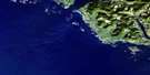
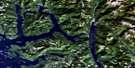
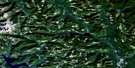
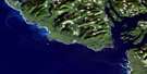
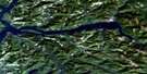
Bartlett Island Satellite Image Map
Download Free Aerial Photo 092E01 at 1:50,000 scale
Bartlett Island Satellite Imagery
To view this satellite map, mouse over the air photo on the right.
You can also download this satellite image map for free:
092E01 Bartlett Island high-resolution satellite image map.
Maps for the Bartlett Island aerial map sheet 092E01 at 1:50,000 scale are also available in these versions:
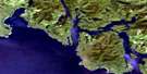
Bartlett Island Surrounding Area Aerial Photo Maps
 |
 |
 |
|
 |
 |
||
 |
 |
||
 |
© Department of Natural Resources Canada. All rights reserved.
Bartlett Island Gazetteer
The following places can be found on satellite image map 092E01 Bartlett Island:
Bartlett Island Satellite Image: Bays
Ahous BayBartlett Island Satellite Image: Capes
Ahous PointCut Coast Point
Kutcous Point
Bartlett Island Satellite Image: Channels
Brabant ChannelCalmus Passage
Clayoquot Sound
North Channel
Russell Channel
Bartlett Island Satellite Image: Indian Reserves
Ahous Indian Reserve 16Bartlett Island Indian Reserve 32
Chetarpe Indian Reserve 17
Kutcous Point Indian Reserve 33
Réserve indienne Ahous 16
Réserve indienne Bartlett Island 32
Réserve indienne Chetarpe 17
Réserve indienne Kutcous Point 33
Bartlett Island Satellite Image: Islands
Bare IslandBartlett Island
Blunden Island
Burgess Islet
Cleland Island
Flores Island
Garrard Group
Hobbs Islet
Île de Vancouver
Kutcous Islets
La Croix Group
Lawrence Islets
Leeke Islets
Monks Islet
Rugged Group
Shag Islet
Shot Islets
Tibbs (White) Islet
Tibbs Islet
Twin Islets
Vancouver Island
Vargas Island
Whaler Islets
White Island
Bartlett Island Satellite Image: Major municipal/district area - major agglomerations
Regional District of Alberni-ClayoquotBartlett Island Satellite Image: Conservation areas
Vargas Island ParkBartlett Island Satellite Image: Shoals
Eby RockEdwin Reef
Foam Reefs
Hagen Reef
Half-tide Rock
Plover Reefs
Sea Otter Rock
Shag Rock
Shark Reef
Bartlett Island Satellite Image: Unincorporated areas
ChetarpeChetarpe Village
Old Ahousat

© Department of Natural Resources Canada. All rights reserved.
