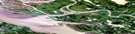
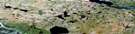
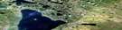
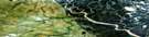
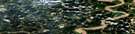
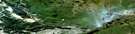
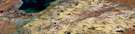
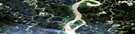
Reindeer Station Satellite Image Map
Download Free Aerial Photo 107B11 at 1:50,000 scale
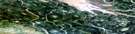
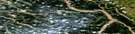
Reindeer Station Satellite Imagery
To view this satellite map, mouse over the air photo on the right.
You can also download this satellite image map for free:
107B11 Reindeer Station high-resolution satellite image map.
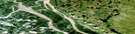
Maps for the Reindeer Station aerial map sheet 107B11 at 1:50,000 scale are also available in these versions:
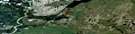
Reindeer Station Surrounding Area Aerial Photo Maps
 |
 |
 |
 |
 |
 |
 |
 |
 |
 |
 |
 |
 |
 |
 |
 |
© Department of Natural Resources Canada. All rights reserved.
Reindeer Station Gazetteer
The following places can be found on satellite image map 107B11 Reindeer Station:
Reindeer Station Satellite Image: Capes
Mackenzie DeltaNet Point
Reindeer Station Satellite Image: Channels
Amagokvik ChannelBig Jim Channel
Bombardier Channel
Crooked Channel
East Channel
Guvraglik Channel
Kipnik Channel
Luker Channel
Middle Channel
Napoiak Channel
Oniak Channel
Pederson Channel
Savevrak Channel
Thrasher Channel
Tingmiak Channel
Tumma Channel
Reindeer Station Satellite Image: Islands
Harrison IslandWilliams Island
Reindeer Station Satellite Image: Lakes
Hill LakeScissor Lakes
Reindeer Station Satellite Image: Mountains
Caribou HillsReindeer Station Satellite Image: Rivers
Axel CreekLester Creek
Reindeer Station Satellite Image: Territory
Northwest TerritoriesTerritoires du Nord-Ouest
Reindeer Station Satellite Image: Unincorporated areas
Reindeer Station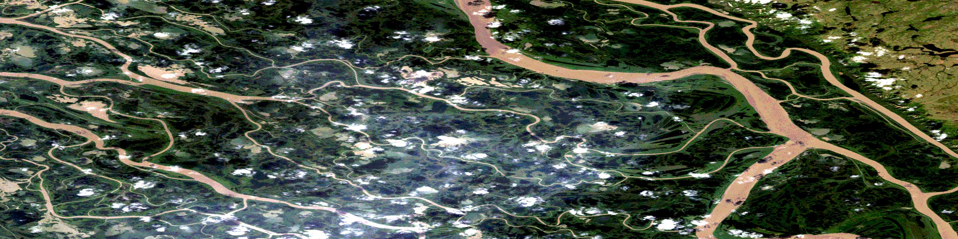
© Department of Natural Resources Canada. All rights reserved.
107B Related Maps:
107B Aklavik107B01 Lost Reindeer Lakes
107B02E Campbell Lake
107B02W Campbell Lake
107B03E Aklavik Channel
107B03W Aklavik Channel
107B04 Aklavik Range
107B05E Beaver House Creek
107B05W Beaver House Creek
107B06E Schooner Channel
107B06W Schooner Channel
107B07 Inuvik
107B08 No Title
107B09 No Title
107B10E Noell Lake
107B10W Noell Lake
107B11E Reindeer Station
107B11W Reindeer Station
107B12E Leland Channel
107B12W Leland Channel
107B13E Shallow Bay
107B13W Shallow Bay
107B14E Wolverine Lakes
107B14W Wolverine Lakes
107B15E Parsons Lake
107B15W Parsons Lake
107B16 Old Man Lake
