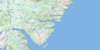
St John's Topo Map Online
Download Free Topo Map Sheet 001N10 at 1:50,000 scale
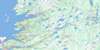
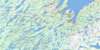
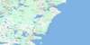
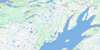
001N10 St John's Topo Map
To view this map, mouse over the map preview on the right.
You can also download this topo map for free:
001N10 St John's high-resolution topo map image.
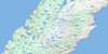
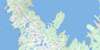
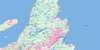
Maps for the St John's topo map sheet 001N10 at 1:50,000 scale are also available in these versions:
St John's Surrounding Area Topo Maps
 |
 |
 |
|
 |
 |
 |
|
 |
 |
 |
|
 |
 |
 |
© Department of Natural Resources Canada. All rights reserved.
St John's Gazetteer
The following places can be found on topographic map sheet 001N10 St John's:
St John's Topo Map: Bays
Beachy CoveBig Cove
Big Freshwater Cove
Blackhead Bay
Bobbies Cove
Bottle Cove
Boulders Cove
Broad Cove
Broad Cove
Bull Cove
Cantwells Cove
Cape Bay
Caplin Cove
Chimney Cove
Chimney Cove
Church Cove
Conception Bay
Cow Cove
Crane Gulch
Cuckold Cove
Cuckolds Cove
Cuckolds Cove
Dark Hole Cove
Dead Mans Cove
Deadmans Bay
Dogs Hole
Doyles Cove
Flat Rock Cove
Frederick Cove
Freshwater Bay
Freshwater Cove
Gallows Cove
Gladneys Arm
Goat Cove
Green Gulch
Green Head Cove
Gunners Cove
Hay Cove
Herring Cove
Hole in the Head
Jackmans Cove
Jessie Codners Hole
Jobs Cove
Jones Cove
Jones Cove
Kelby Cove
Kings Cove
Klondyke Gulch
Knights Arm
Knights Cove
Little Cove
Little Freshwater Cove
Little Gallows Cove
Little Jones Cove
Logy Bay
Long Harry Cove
Long Pond Gut
Lower Big Cove
Lower Herring Cove
Lower Horse Cove
Mannings Cove
Middle Cove
Murdering Gulch
Murphys Gulch
North Hole
Number Two Cove
Ochre Cove
Ochre Pit Cove
Outer Cove
Paper Cove
Peggys Bag
Portugal Cove
Pound Gulch
Powers Cove
Pulpit Cove
Quidi Vidi Harbour
Ragged Head Cove
Red Head Cove
Redmans Cove
Robin Hood Bay
Rolls Cove
Ryans Cove
Sailing Gulch
Sam Cove
Sandy Cove
Saunders Cove
Seals Cove
Ship Cove
Shooting Point Cove
Skerries Bight
Sleepy Cove
Small Point Cove
Smooth Gulch
Sought Bight
South Bight
South Hole
Southwest Arm
Spanish Gulch
Spear Bay
Spout Cove
St. John's Bay
St. John's Harbour
St. Thomas Cove
Stiles Cove
Tappers Cove
The Basin
The Bight
The Circle
The Skerries
Tobias Gulch
Topsail Bight
Topsail Cove
Tor Bay
Torbay Bight
True Blue Gulch
Upper Big Cove
Upper Herring Cove
Upper Herring Gulch
Watsons Cove
Whalens Cove
Windy Cove
Woody Cove
St John's Topo Map: Beaches
Big BeachChamberlains Beach
Lance Cove Beach
Long Pond Beach
Manuels Beach
The Beach
Topsail Beach
Whalens Beach
St John's Topo Map: Capes
Abrams HeadAnchor Point
Avalon Peninsula
Birchy Point
Black Head
Blackhead
Blast Hole Point
Blow Me Head
Bradburys Point
Brocks Head
Cahill Point
Cape Spear
Chamberlains Head
Church Cove Point
Cliff Point
Codfish Point
Cuckold Head
Dark Hole Head
Devils Point
Eastern Head
Ferry Point
Flat Rock Point
Flowers Point
Foxtrap Head
Frosts Island
Grassy Point
Gravel Head
Grebes Nest Point
Greeleys Point
Gull Island North Head
Gull Island South Head
Knights Arm
Lance Cove Head
Long Harry Point
Lower High Point
Manuels Head
Newells Point
North Head
North West Point
Ore Head
Patch Point
Peggys Leg
Peters Point
Piccos Point
Polls Head
Pulpit Head
Ragged Head
Red Head
Redcliff Head
Redmans Head
Redmans Head
Redmonds Head
Sailing Point
Sculpin Point
Sculpin Point
Sculpins Point
Ship Cove Point
Small Point
Small Point
Small Point
Snagge Point
South Head
Spriggs Point
Sugarloaf Head
Swiles Head
The Beamer
The Bill of the Cape
The Gaze
The Lookout
The Parlor
The Peg
Thistles Point
Topsail Head
Torbay Point
Upper Grebes Nest Point
Upper High Point
Wester Point
Wester Point
Whalens Head
Whalens Point
St John's Topo Map: Channels
Bell Island TickleThe Narrows
The Narrows
St John's Topo Map: City
Mount PearlSt. John's
St John's Topo Map: Cliffs
Black CliffBlow Me Down
Grebes Nest
Red Cliff
Soldiers Gulch
The Chalks
The Flats
White Cove Cliff
St John's Topo Map: Falls
The SpoutSt John's Topo Map: Islands
Bell IslandBurnt Island
Fishing Island
Little Bell Island
Sandy Beach
Skerries Islands
Turfys Island
St John's Topo Map: Lakes
Adams PondAxes Pond
Barking Kettle Pond
Bauline Long Pond
Bauline Rocky Pond
Beachy Cove Ponds
Beaver Pond
Beaver Pond
Bentley Pond
Big Pond
Big Punch Bowl Pond
Big Three Corner Pond
Birch Hill Gully
Blast Hole Ponds
Branscombes Pond
Brazil Pond
Bremigens Pond
Brocks Head Pond
Brocks Pond
Bubble Pond
Burtons Pond
Butlers Pond
Butlers Pond
Chamberlains Pond
Chidley Pond
Church Pond
Clements Pond
Cochrane Pond
Cove Pond
Crow Head Pond
Deadmans Pond
Duck Pond
Duck Pond
Duck Pond
Fagans Marsh
First Gully
Freshwater Bay Pond
Freshwater Pond
Frog Pond
Funnell Pond
Gallows Cove Pond
Gallows Cove Ponds
Georges Pond
Georges Pond
Goose Pond
Goughs Gully
Great Pond
Grog Pond
Gull Pond
Gully Pond
Half Moon Pond
Handy Pond
Healeys Pond
Herring Cove Pond
Hickeys Pond
Hogans Pond
Hughs Pond
Inside Gully
Inside Pond
Island Pond
John Howards Pond
Johnny O'Learys Gullies
Johnny O'Learys Gullys
Jones Pond
Juniper Ponds
Kennys Pond
Kents Pond
Lance Cove Pond
Lawlors Gully
Leamys Ponds
Left Pond
Little Duck Pond
Little Gallows Cove Pond
Little Gully
Little Herring Cove Pond
Little Oliver Pond
Little Powers Pond
Little Punch Bowl Pond
Long Gully
Long Pond
Long Pond
Long Pond
MacWilliams Gully
Middle Pond
Middle Pond
Middle Rocky Pond
Middle Three Island Pond
Miles Pond
Millers Pond
Mitchells Pond North
Mitchells Pond South
Moon Pond
Moriartys Pond
Mundy Pond
Murrays Pond
Nearys Pond
Neils Pond
Nevilles Pond
Newfound Pond
North Pond
North Three Island Pond
Northeast Pond
Northwest Pond
Ocean Pond
Octagon Pond
Olivers Pond
Outside Gully
Outside Pond
Oxen Pond
Paddys Pond
Parkers Pond
Petty Harbour Long Pond
Peytons Pond
Piccos Pond
Piccos Pond South
Pond on the Head
Pouch Cove Gully
Powers Pond
Punch Mile Gullies
Quidi Vidi Lake
Robins Pond
Rocky Pond
Rocky Pond
Rogers Gullies
Rogers Tilt Pond
Round Pond
Round Pond
Round Pond
Ryalls Pond
Second Gully
Sheens Pond
Sheep Pen Gully
Shoe Cove Pond
Skerries Pond
Soldiers Brook Pond
Soldiers Pond
South Pond
Stick Pond
Stick Pond
Stickles Pond
Sugarloaf Pond
Three Arm Pond
Three Island Pond
Tommy Whites Pond
Topsail Pond
Topsail Round Pond
Torbaymans Pond
Triangle Pond
Virginia Lake
Watts Pond
West Dam Pond
Western Island Pond
Western Pond
Western Round Pond
Whiteway Pond
Wigmore Pond
Williams Pond
Windsor Lake
Withrod Pond
St John's Topo Map: Marine navigation features
Dominion PierScotia Pier
St John's Topo Map: Military areas
Canadian Forces Station St. John'sStation des Forces canadiennes St. John's
St John's Topo Map: Mountains
Beachy Cove HillBig Hill
Birch Hill
Black Head
Blast Hole Hill
Boulder Highland
Bremigens Ridge
Buckleys Hill
Cape Hill
Church Cove Hill
Coles Hill
Crown Hill
Deadmans Bay Hill
Dogberry Hill
Eastern Ridge
Firewood Hill
Flagstaff Hill
Franks Hill
Frenchmans Ridge
Gibbett Hill
Hel Saal
Hells Al
Kenmount Hill
Knobby Hill
Lockeys Hill
Lokeys Hill
Middle Pond Ridge
Moon Pond Ridge
Morriseys Ridge
Mother Allans Rock
Mount Ken
Mount Scio
Neils Pond Ridge
Nevilles Hill
Paradise Hill
Piccos Ridge
Pipers Stock Hill
Plowed Hill
Princes Lookout
Purcells Ridge
Raymonds Beard Hill
Robbins Hill
Saddle
Signal Hill
Skinners Tolt
Snagge Hill
South Side Hills
Split Rock
St. Andrews Hill
St. Patricks Hill
The Lookout
The Pulpit
Thornes Hill
Tolt
Topsail Highlands
Topsail Hill
Torbay Southern Head
Torbaymans Lookout
Tuckers Hill
Watts Ridge
Western Ridge
White Hills
White Hills
Wickhams Ridge
Wireless Hill
St John's Topo Map: Major municipal/district area - major agglomerations
St. John's Metropolitan AreaSt John's Topo Map: Conservation areas
Bowring ParkCape Spear National Historic Site of Canada
Lieu historique national du Canada de Signal Hill
Lieu historique national du Canada du Cap-Spear
Marine Drive Provincial Park
Middle Cove Provincial Park
Newfoundland T'Railway Provincial Park
Signal Hill National Historic Site of Canada
Topsail Beach Provincial Park
St John's Topo Map: Plains
Raines PlainsSt John's Topo Map: Rivers
Bauline BrookBauline River
Beachy Cove Brook
Big River
Black Brook
Blast Hole Pond River
Broad Cove River
Cartys Stream
Coakers River
Conway Brook
Cross Brook
Drukens River
Flings Brook
Fowlers Brook
Foxtrap River
Goat Cove Brook
Half Moon Brook
Horse Cove Brook
Island Pond Brook
Kellys Brook
Kennedys Brook
Kitty Gauls Brook
Leamys Brook
Learys Brook
Main Brook
Main River
Manuels River
Miles Brook
Millers Pond River
Murrays Pond River
North Pond Brook
Northeast Pond River
Outer Cove Brook
Piccos Brook
Pincombes Brook
Pouch Cove Brook
Pouch Cove Brook West
Rainbow Gullies
Rennie's River
Rocky Brook
Shoe Cove Brook
Soldiers Brook
South Brook
Spear Bay Brook
Steadywater Brook
Stick Pond Brook
Topsail River
Triangle Brook
Virginia River
Voiseys Brook
Waterford River
Yellow Marsh Stream
St John's Topo Map: Shoals
Anchor RockBlackhead Bank
Boulder Rock
Cat Rock
Chain Rock
Cordelia Deeps
Cow and Calf Ledge
Ellinor Rock
Founder Rock
Gull Rocks
Halfway Rock
Island Rock
Island Rock
Little Pancake
Merlin Rock
Old Haman Rock
Old Harry
Pancake Shoal
Petty Harbour Ledges
Pot Rock
Prosser Rock
Redhead Rock
Ruby Rock
Seal Rock
Shag Rocks
Sly Boots
Spar Rock
St. Georges Leads
Tantam Rock
Tantam Shoals
The Chest
The Divers
The Rags
The Riband
The Whale
Tinker Bank
Tinker Rock
Vestal Rock
Washballs
Whaleback Rock
White Rock
Winter Bank
Yellow Moll
St John's Topo Map: Towns
BaulineConception Bay South
Flatrock
Glendale
Logy Bay-Middle Cove-Outer Cove
Mount Pearl Park-Glendale
Paradise
Paradise-St. Thomas
Portugal Cove-St. Philip's
Portugal Cove-St. Phillips-Hogan's Pond
Pouch Cove
Torbay
Wabana
St John's Topo Map: Unincorporated areas
Bally HalyBell Island
Bell Island Front
Birchy Nap
Blackhead
Blackhead Road
Cahill Point
Chamberlains
Churchill Park
Codner
Donovans
East Meadows
Evergreen Village
Flatrock
Fort Townshend
Fort William
Foxtrap
Georgestown
Glendale
Glenridge Crescent
Glenvilla Court
Greeleytown
Hogan's Pond
Hoylestown
Irvine
Kilbride
Lance Cove
Logy Bay
Long Pond
Manuels
Middle Cove
Mount Cashel
Mount Pearl Park
Newton
North Pond Heights
Otterbury
Outer Cove
Peachytown
Penetanguishene
Pleasantville
Portugal Cove
Quidi Vidi
Rabbit Town
Ricketts Bridge
Saint Annes Industrial Park
Sand Pits
Shea Heights
Shoe Cove
St. Philip's
St. Phillips
St. Phillip's
St. Thomas
Talcville
Tanguishene
The Battery
The Front
The Green
Thorburn Road
Topsail
Virginia Park
Waterford Bridge
Wedgewood Park
West Mines
Windsor Heights
Wishingwell Park
Woodstock
St John's Topo Map: Valleys
Big DrakeCrane Gulch
Freshwater Valley
Kellys Brook
The Scrape
St John's Topo Map: Low vegetation
Bakeapple MarshBerry Marsh
Bill Kennedys Bog Hole
Black Marsh
Cartys Marsh
Deadmans Pond
Deer Marsh
Featherbed Marsh
Flannery Barren
Fogartys Meadows
Frenchmans Marsh
Grassy Marsh
Holes In The Marsh
Hummocky Marsh
Island Pond Marsh
Juniper Marsh
Juniper Stump
Knights Marsh
Long Run Bog
Moores Garden
Pouch Cove Marsh
Round Juniper Marsh
Spring Well
Summer Marsh
The Level
Three Pond Barrens
Walshs Marsh
Yellow Marsh
St John's Topo Map: Villages
Flat Rock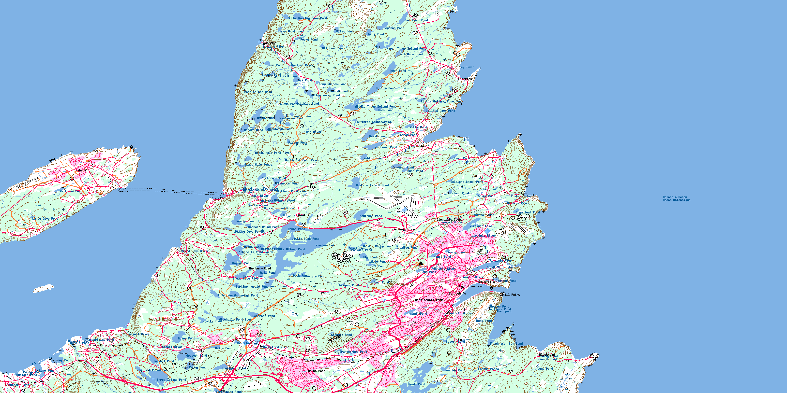
© Department of Natural Resources Canada. All rights reserved.
