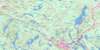
Sambro Topo Map Online
Download Free Topo Map Sheet 011D05 at 1:50,000 scale
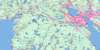
011D05 Sambro Topo Map
To view this map, mouse over the map preview on the right.
You can also download this topo map for free:
011D05 Sambro high-resolution topo map image.
Maps for the Sambro topo map sheet 011D05 at 1:50,000 scale are also available in these versions:
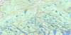
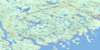
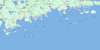
Sambro Surrounding Area Topo Maps
 |
 |
 |
 |
 |
 |
 |
|
 |
|||
© Department of Natural Resources Canada. All rights reserved.
Sambro Gazetteer
The following places can be found on topographic map sheet 011D05 Sambro:
Sambro Topo Map: Bays
Back BayBack Cove
Back of Blackburns Cove
Barbara Basin
Big Cairn Cove
Big Fish Cove
Big Hauling Cove
Big Sandy Cove
Bishops Cove
Blackberry Cove
Blind Bay
Blood Cove
Bowmans Cove
Broad Cove
Broad Cove
Broad Cove
Burns Cove
Butter Cove
Cheaters Cove
Clancys Cove
Codline Cove
Coote Cove
Coyle Cove
Cranberry Cove
Cub Basin
Dark Cove
D'Aubins Cove
Deep Cove
Deep Cove
Dogwood Cove
Dogwood Creek
Dover Harbour
Dover Soi
Duck Cove
Duncan Cove
Duncans Cove
Dutchman Cove
Eastern Cove
Faders Cove
Fawson Cove
Fink Cove
Fishers Nose Cove
Flinn Cove
Gallons Cove
Gill Cove
Grays Cove
Grover Cove
Halfway to the Point Cove
Halloran Cove
Hardeman Cove
Hardiman Cove
Hay Cove
Herring Hole
Holland Cove
Holland Cove
Indian Harbour
Island Rock Cove
Joan Cove
Joes Cove
Keatings Cove
Kelp Cove
Ketch Harbour
Kileys Cove
Laceys Cove
Laceys Cove
Leary Cove
Little Cairn Cove
Long Cove
Long Cove
Loon Cove
Lower Arm of the Roost
Lower Bar Harbour
Lower Duck Cove
Lower Prospect Cove
Mackerel Cove
Mackerel Cove
Mud Hole
Mullins Cove
Murphy Cove
Northeast Cove
Northwest Cove
Peggy Cove
Peggy Soi
Peggys Cove
Peggy's Cove
Peggys Cove Soi
Peggy's Soi
Pennant Bay
Pennant Cove
Pennant Harbour
Pennant Point Cove
Phantom Cove
Polly Cove
Pond Cove
Porcupine Cove
Port Dover
Prospect Bay
Rileys Cove
Rogues Roost
Round Hole
Salmon Cove
Sambro Basin
Sambro Creek
Sambro Harbour
Sand Cove
Sandy Cove
Sandy Cove
Sandy Cove
Seine Cove
Shad Bay
Shag Bay
Smiths Cove
Snows Cove
Southwest Cove
Stem Cove
Terence Bay
The Alley
The Basin
The Guzzle
Upper Arm of the Roost
Upper Bar Harbour
Upper Cove
Upper Duck Cove
Upper Schoolhouse Cove
Watering Cove
Watering Cove
Weasel Cove
Western Cove
Whale Cove
Whistlers Cove
Whitehorse Cove
Winterhouse Cove
Wreck Cove
Wreck Cove
Wreck Cove
Wreck Cove
Sambro Topo Map: Beaches
Barren ShoreBilbys Beach
Broad Breaker
Crystal Crescent Beach
Deadmans Beach
Flat Rock Beach
Georges Beach
Lobster Claw Beach
Long Beach
Martins Beach
Sallys Beach
Schnares Beach
Shad Bay Breakers
Shag Bay Breakers
Smiths Beach
Southwest Breaker
The Conch Beach
Wagners Beach
Sambro Topo Map: Capes
Archies PointBald Rock Head
Bear Point
Berry Point
Black Point
Black Point
Bluff Head
Brig Point
Bull Point
Bull Rock Point
Burns Point
Burying Head
Cape Sambro
Church Point
Church Point
Codline Point
Coles Head
Cook Head
Cook Point
Coyle Head
Cranberry Head
D'Aubins Point
Duck Cove Head
Duck Cove Head
Eastern Head
Eastern Point
Faders Point
Fawsons Point
Fishers Nose
Flying Point
Gill Cove Head
Hennesseys Head
Indian Point
Island Rock Head
John Noonans Head
Keatings Point
Kelly Point
Ketch Head
Kileys Head
Leary Point
Little Head
Long Cove Point
Lower Cheaters Head
Marrs Head
Mars Head
Martins Point
Micks Point
Money Point
Morris Point
Nelsons Point
Norris Head
Northern Head
Nowlans Point
O'Briens Point
Peggy Point
Peggys Point
Peggy's Point
Pennant Big Head
Pennant Point
Pete Point
Phantom Point
Ragged Head
Reef Head
Ryans Point
Ryans Point
Sailors Head
Sand Cove Head
Sandy Cove Point
Saul Point
Scott Point
Shad Bay Head
Shag Head
Sheepdog Point
Shipley Head
Shoal Point
Soi Point
Splitnose Point
Strawberry Point
Tennant Point
The Castle
The High Head
Tobins Head
Upper Cheaters Head
Watering Cove Head
Watering Cove Point
Western Head
Whitehorse Point
Sambro Topo Map: Channels
Brophys RunNorris Gut
Privateer Passage
Purcells Narrows
Ryans Gut
Sambro Channel
The Narrows
The Run
Sambro Topo Map: Cliffs
Metahead BankSambro Topo Map: Geographical areas
HalifaxSambro Topo Map: Islands
Arts IslandBaker Island
Bakers Island
Ball Rock
Bartlett Island
Betty Island
Big Island
Breakfast Island
Burnt Island
Callahan Island
Cat Island
Clarks Island
Coles Island
Corneys Island
Cracker Island
Dover Castle
Dover Island
Duck Island
Evans Island
Fleming Island
Flemming Island
Germans Island
Hearn Island
Hennesseys Island
High Island
Hopson Island
Indian Island
Inner Gull
Inner Gull Island
Inner Sambro Island
Isle of Man
Jeffreys Island
Keighans Island
Laceys Island
Little Castle
Little Island
Little Island
Little Woody Island
Long Island
Lower Woody Island
Mackerel Island
Marrs Island
Martin Island
Moore Island
Moores Island
Moosehead Island
Mosher Island
Myers Island
Norris Island
Norris Island
Otter Island
Outer Gull
Outer Gull Island
Pennant Island
Pig Island
Poor Island
Power Island
Power Island
Powers Island
Powers Island
Prettys Island
Privateer Island
Purcell Island
Purcells Island
Rat Island
Rat Island
Redmond Island
Roger Power Island
Roost Island
Ryan Island
Ryans Island
Saddle Island
Sambro Island
Saul Island
Seven Islands
Shannon Island
Sheas Island
Sheehans Island
Simmons Island
Southwest Island
Strawberry Island
Taylor Island
The Eastern End
The Little Islands
Thrumcap Island
White Island
Woody Island
Sambro Topo Map: Lakes
Bar Harbour LakeBarachois Lake
Barachois Pond
Black Duck Lake
Brophy Back Lake
Brophy Lake
Brophys Back Lake
Brophys Front Lake
Burnthill Lake
Canal Lake
Clam Pond
Daddy Lake
Dadies Lake
Duncan Lake
Duncans Cove Pond
First Pond
Fourth Pond
Goose Pond
Grand Lake
Gray Lake
Grey Lake
High Island Pond
Hospital Hill Lake
Keatings Roost
Lily Pond
Little Brophy Lake
Little Burnthill Lake
Little Lake
Little Pond
Little Trout Lake
Long Canal Lake
Long Lake
Long Pond
Loon Cove Lake
Nick Pond
Norris Back Lake
Norris Lake
Norris Pond
Pork Hole
Quarry Lake
Ragged Lake
Reardons Hole
Roost Pond
Round Pond
Seligs Pond
Sheehan Lake
Shellbird Lake
The Barachois
Third Pond
Whale Cove Lake
Sambro Topo Map: Mountains
Big MountainCrows Nest
Dover Hill
Green Hill
Hospital Hill
Reach Hill
The High Barrens
Yellow Hill
Sambro Topo Map: Major municipal/district area - major agglomerations
HalifaxSambro Topo Map: Conservation areas
Crystal Crescent Provincial ParkWilliam E. DeGarthe Memorial Provincial Park
Sambro Topo Map: Rapids
Sheehans RunSambro Topo Map: Rivers
Boatswain RunGaspereaux Run
Grand Lake Run
Long Cove Brook
Pennant River
Smelt Brook
Terence Bay River
The Long Lane
Sambro Topo Map: River features
Terence BasinSambro Topo Map: Sea features
The HospitalSambro Topo Map: Shoals
Bald RockBald Rock
Bald Rock
Ball Rock
Barrington Rock
Barse Ground
Barse Rock
Basin Rock
Bell Rock
Big Head Rock
Bigfish Shoal
Black Point Ledge
Black Reef
Black Rock
Black Rock
Black Rock
Black Rock
Black Shoal
Blackburns Rock
Blind Sister
Blind Tom
Bobby Ledge
Bobbys Ledge
Broad Rock
Broad Shoal
Brow Rock
Bull Rock
Bull Rock
Cabbage Garden Shoals
Cat Ledge
Chubb Rock
Coles Island Rock
Coles Rock
Colt Shoal
Connor Reef
Corney Rock
Cory Rock
Cowley Rock
Croak Rock
Cronie Reef
Devereux Shoal
Devils Seat
Dogfish Ground
Dollar Rock
Duck Island Rock
Duck Reef
Duncan Reef
East Shoal
Eastern Frying Pans
Ede Rock
Eldad Ledge
Fairweather Rock
Fawson Rock
Flatroof Shoal
Fleming Ledge
Flemming Ledge
Frying Pan Rock
Green Shoal
Gull Rock
Gull Shoal
Gun Rock
Halibut Rock
Head Rock
Hennessey Bank
Hennesy Bank
Hens and Chickens
Horse Shoal
Horseshoe Ledge
Island Rock
Kelly Ledge
Kellys Ledge
Kitiwiti Shoal
Laceys Cove Chuckle
Little Pollock
Lobster Claw
Lynch Rocks
Mad Rock
Mad Rock
Mare Shoal
Merlin Rock
Middle Ground
Middle Ground
Middle Ground
Morris Point Shoal
Nick Shoal
Norris Bald Rock
Norris Rock
Outer Bank
Paddle Rock
Peddlar Rock
Pennel Shoal
Phillips Shoal
Pollock Shoal
Polly Cove Rock
Polly Cove Rock
Puffer Shoal
Round Rock
Sambro Ledges
Sand Cove Head Shoal
Sand Head Shoal
Sand Shoal
Seal Rock
Shag Rock
Shannons Flat Rock
Shark Rock
Shoal Ground
Smithson Rock
South Rock
Southeast Shoal
Southwest Shoal
Stapleton Rock
Stapleton Rock
Terence Bay Rock
The Clump
The Cow and Calf
The Grampus
The Puffer
The Sisters
Thrumcap Rock
Torpey Ledge
Western Frying Pans
Whale Cove Chuckle
Whaleback Rock
White Rocks
Whitehorse Rock
Wippy Rock
Wreck Cove Rock
Sambro Topo Map: Unincorporated areas
Bald RockDover West
Duncan Cove
Duncans Cove
East Dover
East Pennant
Ketch Harbour
Lower Prospect
Peggy Cove
Peggys Cove
Peggy's Cove
Pennant
Prospect
Sambro
Sambro Creek
Sambro Head
Sandy Cove
Terence Bay
Terence Bay River
West Dover
West Pennant
Williamswood
Sambro Topo Map: Low vegetation
Isaacs Marsh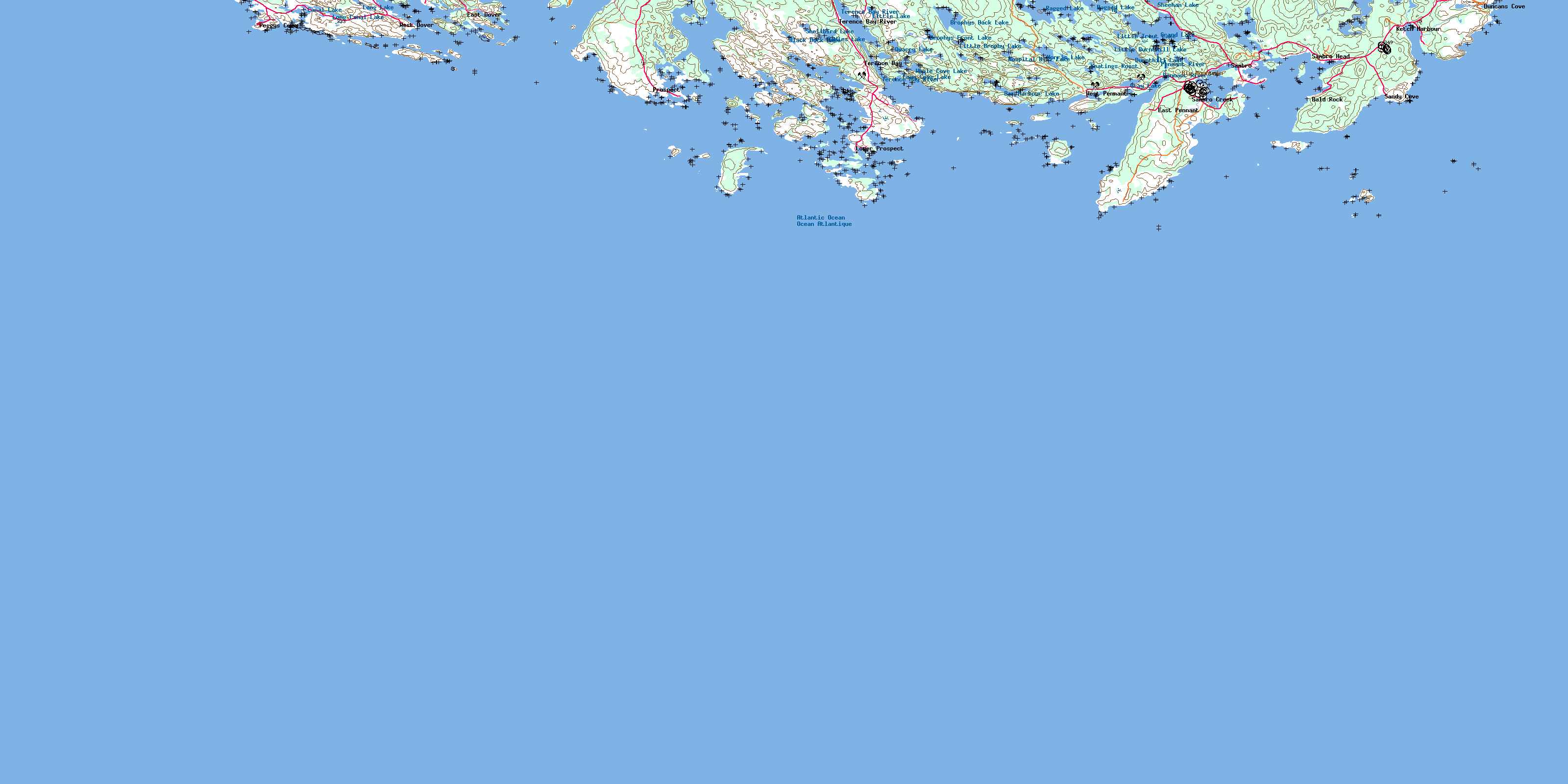
© Department of Natural Resources Canada. All rights reserved.
