Cape North Topo Map Online
Download Free Topo Map Sheet 011N01 at 1:50,000 scale
011N01 Cape North Topo Map
To view this map, mouse over the map preview on the right.
You can also download this topo map for free:
011N01 Cape North high-resolution topo map image.
Maps for the Cape North topo map sheet 011N01 at 1:50,000 scale are also available in these versions:
Cape North Surrounding Area Topo Maps
 |
|||
 |
|||
 |
|||
 |
 |
 |
© Department of Natural Resources Canada. All rights reserved.
Cape North Gazetteer
The following places can be found on topographic map sheet 011N01 Cape North:
Cape North Topo Map: Bays
Aspy BayAtlantic Cove
Bay St. Lawrence
Crogan Cove
Factory Cove
Goat Rock Cove
Golfe du Saint-Laurent
Gulf of St. Lawrence
Hay Cove
Jessie Cove
Jessies Cove
Little Harbour
MacDougall Cove
McLeods Cove
North Martin Powers Cove
Petries Cove
Powers Cove
South Martin Powers Cove
St. Lawrence Bay
Trinity Cove
Viceroy Cove
Cape North Topo Map: Capes
Big Goat RockBig Head
Cape North
Little Goat Rock
Lookout Point
Mica Head
Money Point
Moon Point
North Point
Northeast Point
Norwegian Head
Peters Point
Petries Point
Salmon Point
Shag Roost
South Point
Southwest Point
West Point
Whistle Point
White Rock
Cape North Topo Map: Channels
Cabot StraitCabot Strait
Détroit de Cabot
Détroit de Cabot
The Tickle
Cape North Topo Map: Geographical areas
VictoriaCape North Topo Map: Islands
Cape Breton IslandÎle du Cap-Breton
St. Paul Island
Cape North Topo Map: Lakes
Deadmans PondEthel Lake
Lena Lake
McDougall Pond
Peters Pond
Petries Pond
Cape North Topo Map: Mountains
Crogan MountainMartin Powers Mountain
Mount Groggan
Norwegian Mountain
Cape North Topo Map: Major municipal/district area - major agglomerations
VictoriaCape North Topo Map: Rivers
Gulch BrookSalmon River
Cape North Topo Map: Shoals
Anchor RockBartar Rocks
Big Dick Rock
Little Dick Rock
Money Rocks
Northeast Bank
Northwest Bank
Paddy Rock
Roarer Rocks
Sacrifice Rocks
Shag Rock
Cape North Topo Map: Unincorporated areas
Bay St. Lawrence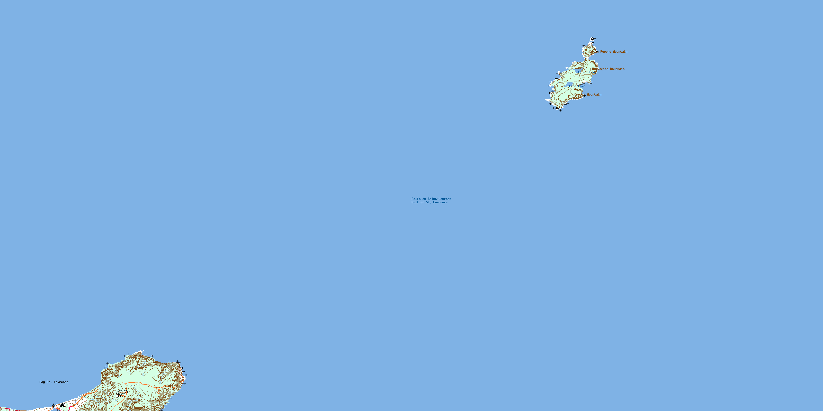
© Department of Natural Resources Canada. All rights reserved.
