Pass Island Topo Map Online
Download Free Topo Map Sheet 011P08 at 1:50,000 scale
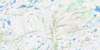
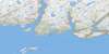
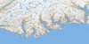
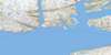
011P08 Pass Island Topo Map
To view this map, mouse over the map preview on the right.
You can also download this topo map for free:
011P08 Pass Island high-resolution topo map image.
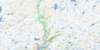
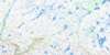
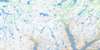
Maps for the Pass Island topo map sheet 011P08 at 1:50,000 scale are also available in these versions:
Pass Island Surrounding Area Topo Maps
 |
 |
 |
 |
 |
 |
 |
 |
 |
|||
© Department of Natural Resources Canada. All rights reserved.
Pass Island Gazetteer
The following places can be found on topographic map sheet 011P08 Pass Island:
Pass Island Topo Map: Bays
Beck BayFortune Bay
Golfe du Saint-Laurent
Gulf of St. Lawrence
Saltwater Cove
Seal Cove
The Bight
Pass Island Topo Map: Capes
Basse Terre PointEastern Point
Red Point
Pass Island Topo Map: Channels
Pass Island TicklePass Island Topo Map: Islands
Lady IslandPass Island
Salmon Island
Seal Island
Pass Island Topo Map: Lakes
Big BaraswayLittle Barasway
Pass Island Topo Map: Shoals
Brunnette BankGreville Shoal
Offer Bank
Old Man Place
Tom Cod Rock
Wolf Rocks
Pass Island Topo Map: Towns
Seal CovePass Island Topo Map: Unincorporated areas
Pass Island
© Department of Natural Resources Canada. All rights reserved.
