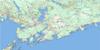
Musquash Topo Map Online
Download Free Topo Map Sheet 021G01 at 1:50,000 scale
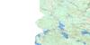
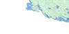
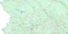
021G01 Musquash Topo Map
To view this map, mouse over the map preview on the right.
You can also download this topo map for free:
021G01 Musquash high-resolution topo map image.
Maps for the Musquash topo map sheet 021G01 at 1:50,000 scale are also available in these versions:
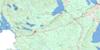
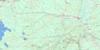
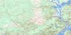
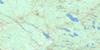
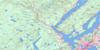
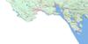
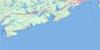
Musquash Surrounding Area Topo Maps
 |
 |
 |
 |
 |
 |
 |
 |
 |
 |
 |
|
 |
 |
 |
© Department of Natural Resources Canada. All rights reserved.
Musquash Gazetteer
The following places can be found on topographic map sheet 021G01 Musquash:
Musquash Topo Map: Bays
Anthonys CoveBack Cove
Baie de Fundy
Bay of Fundy
Beldings Cove
Black Duck Hole
Boyles Cove
Campbells Back Cove
Campbells Cove
Chance Harbour
Cobb Cove
Coleson Cove
Connor Cove
Connors Cove
Crafts Cove
Dipper Harbour
Dipper Harbour Back Cove
Duck Cove
Duck Cove
Five Fathom Hole
Gooseberry Cove
Haleys Cove
Halls Bay
Halls Cove
Harbour by Chance
Harbour by Chance
Hepburn Basin
Indian Cove
Lepreau Harbour
Lighthouse Cove
Little Dipper Harbour
Little Lepreau Basin
Little Musquash Cove
Lobster Cove
Lorneville Cove
Lorneville Creek
Lorneville Harbour
Maces Bay
Maguires Cove
Manawagonish Cove
Mill Cove
Musquash Harbour
Plumper Hole
Round Meadow Cove
Saint John Harbour
Sand Cove
Spillanes Cove
Wallace Cove
Welch Cove
Musquash Topo Map: Beaches
Black BeachCheeseman Beach
Evans Beach
McLarens Beach
McLaren's Beach
Saints Rest Beach
Musquash Topo Map: Capes
Barbours PointBlack Point
Campbells Point
Cranberry Head
Cranberry Point
Devine Point
Fishing Point
Franks Head
Hardy Point
Lighthouse Point
Lorneville Point
McPhersons Point
Musquash Head
Negro Head
Negro Point
Negro Town Point
Negrotown Point
Point Lepreau
Red Point
Reef Point
Reid Point
Seely Point
Shaws Point
Sheldon Point
Taylor Peninsula
The Bar
Tims Point
Tiner Point
Western Head
Wilson Point
Musquash Topo Map: Channels
Back ChannelThe Narrows
West Channel
Musquash Topo Map: City
Saint JohnMusquash Topo Map: Falls
Big FallsLepreau Falls
Little Falls
Ragged Falls
Musquash Topo Map: Geographical areas
CharlotteKings
Lancaster
Lepreau
Musquash
Saint John
Westfield
Musquash Topo Map: Hydraulic construction
Log Falls DamLorneville Breakwater
Negro Point Breakwater
Scott Falls Dam
Musquash Topo Map: Islands
Anderson IslandCrow Island
Gooseberry Island
Hardy Island
Head Island
Manawagonish Island
Musquash Island
Partridge Island
Salkeld Islands
Stillwater Island
Taylors Island
Thrumcap Island
Thumb Cap
Musquash Topo Map: Lakes
Anderson LakeBlack Lake
Bonny Doone Lake
Cain Lake
Clear Lake
Connor Lake
Connors Lake
Cranberry Lake
Deer Lake
Dicks Lake
East Branch Reservoir
East Musquash Reservoir
Ferguson Lake
Garbutt Lake
Grassy Lake
Grassy Lakes
Green Lake
Halls Lake
Hanson Long Lake
Hay Flats Lake
Hideaway Lake
Holman Lake
Jarvies Lakes
Joshua Lake
Lindy Lake
Little John Lake
Loch Alva
Ludgate Lake
Ludgates Lake
Lugrin Lake
Maguires Lake
Marchs Lake
Mawhinney Lake
McKnight Lake
Menzies Lake
Perch Lake
Ragged Falls Flowage
Retreat Lake
Rogers Lake
Scotchman Lake
Scott Lake
Seven Mile Lake
Shadow Lake
Shannons Lake
Spectacle Lakes
Spruce Lake
West Branch Reservoir
West Musquash Reservoir
Wolf Lake
Musquash Topo Map: Mountains
Andy MountainCrane Mountain
Giants Steps
Hardwood Hill
Harvey Hill
Jarvies Mountain
Jarvis Hill
Keyhole Hills
Liberty Hill
Marshall Mountain
Paddys Hill
Sams Hill
Squaw Cap
Musquash Topo Map: Conservation areas
HMS PlumperÎle Partridge
Lepreau Falls Provincial Park
Partridge Island
Musquash Topo Map: Rivers
Anthonys BrookAtkinson Brook
Bean Brook
Belvidere Stream
Beyea Brook
Burchills Brook
Deer Lake Stream
Dipper Harbour Creek
East Branch Musquash River
East Musquash River
East Musquash River
Falls Brook
Ferguson Creek
First Brook
Fishing Stream
Frenchmans Creek
Goose Creek
Hanson Stream
Hay Brook
Lepreau River
Little Lepreau River
Lorneville Creek
Manawagonish Creek
Marsh Brook
Matthews Lake Brook
McLaughlin Creek
Meadow Brook
Menzies Creek
Menzies Stream
Mill Creek
Mill Creek
Mill Creek
Moose Creek
Musquash River
Perch Brook
Perch Brook
Quigley Meadow Brook
Roachs Creek
Second Creek
Serpentine Stream
Smith Lake Brook
Spruce Lake Outlet
Spruce Lake Stream
Stinsons Brook
Stony Creek
Stony Creek
West Branch Musquash River
West Musquash River
Wetmore Creek
Musquash Topo Map: Shoals
Dipper LedgesDog Rocks
Dry Ledge
Island Bar
Maces Bay Ledges
Man Rock
Mann Rock
Molly Brown Rock
Musquash Ledges
Plumper Rock
Pork Ledge
Shag Rocks
Split Rock
White Rocks
Musquash Topo Map: Unincorporated areas
Allan CotAnthonys Cove
Bay Shore
Black Beach
Chance Harbour
Churchill Heights
Colpitts
Dipper Harbour
Dipper Harbour East
Dipper Harbour West
Duck Cove
Fairville Plateau
Five Fathom Cove
Five Fathom Hole
Frenchmans Creek
Fundy Heights
Gooseberry Cove
Island View Heights
Lepreau
Little Lepreau
Lorneville
Ludgate Lake
Maces Bay
Menzies
Mink Brook
Musquash
Old Ridge
Prince of Wales
Purdys Corner
Quinton Heights
Red Head
Seaview
South Musquash
Spruce Lake
Taylors
Welch Cove

© Department of Natural Resources Canada. All rights reserved.
