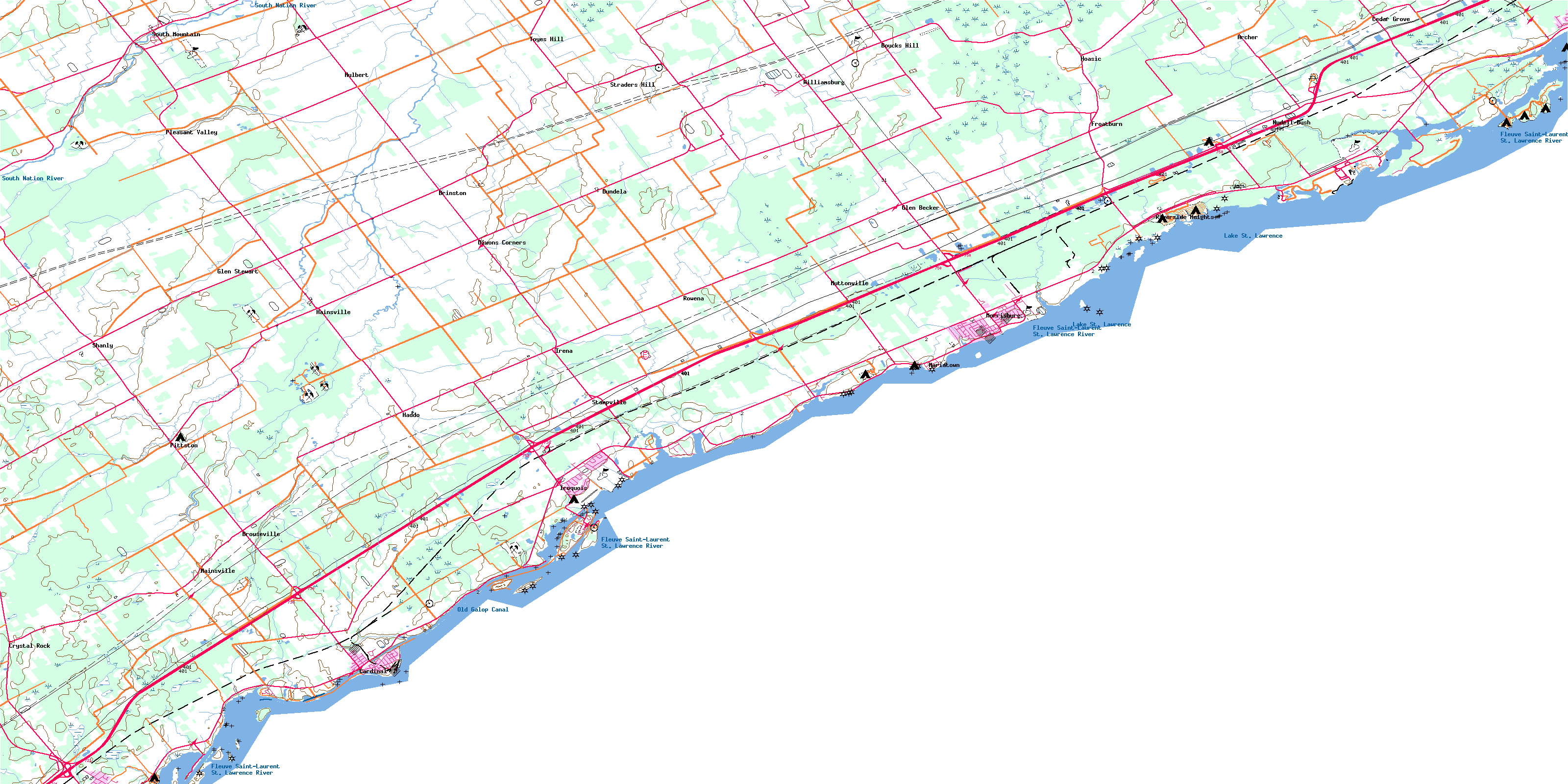
Morrisburg Topo Map Online
Download Free Topo Map Sheet 031B14 at 1:50,000 scale
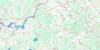
031B14 Morrisburg Topo Map
To view this map, mouse over the map preview on the right.
You can also download this topo map for free:
031B14 Morrisburg high-resolution topo map image.
Maps for the Morrisburg topo map sheet 031B14 at 1:50,000 scale are also available in these versions:
Morrisburg Surrounding Area Topo Maps
 |
 |
||
 |
|||
 |
|||
© Department of Natural Resources Canada. All rights reserved.
Morrisburg Gazetteer
The following places can be found on topographic map sheet 031B14 Morrisburg:
Morrisburg Topo Map: Bays
Cook BayFlagg Bay
Mariatown Bay
Marina Bay
Stata's Bay
Morrisburg Topo Map: Beaches
Crysler BeachIroquois Beach
Morrisburg Beach
Morrisburg Topo Map: Capes
Cooks PointDawsons Point
Doran Point
Iroquois Point
Macdonald Point
Pinetree Point
Point Iroquois
Rapide Plat Point
Robertson Point
Tuttle Point
Weaver Point
Whitney Point
Windmill Point
Morrisburg Topo Map: Channels
North ChannelThe Gut
Morrisburg Topo Map: Geographical areas
DundasEdwardsburgh
Grenville
Matilda
Mountain
Osnabruck
South Gower
Stormont
Williamsburgh
Morrisburg Topo Map: Hydraulic construction
Ault DrainBarkley Drain
Barkley-Johnson Drain
Beckstead Drain
Beggs-Barkley Drain
Beggs-Workman Drain
Brown Drain
Casselman-Dawley Drain
Charles M. Whittaker Drain
Cooper-Thompson Drain
D. Beckstead Drain
Devlin Drain
Donald Hanes Drain
English Drain
Ferguson Drain
Foster Drain
Gogo Drain
Joe Channette Drain
Joe Shannette Drain
Marselis Drain
Mattice Drain
McMartin Drain
Moffatt-Fetterly Drain
Monroe Drain
S.I. Casselman Drain
Saddlemire Drain
Shaver-Harper Municipal Drain
Southworth-Gallinger Drain
Thompson-Errington Drain
Thorpe-Ellis Drain
Van Moorsell Drain
Whittaker Drain
Wilson Drain
Zeron Drain
Morrisburg Topo Map: Indian Reserves
Akwesasne Indian Reserve 59Réserve indienne Akwesasne 59
Morrisburg Topo Map: Islands
Adams IslandAult Island
Ault Island
Broder Island
Canada Island
Doran Island
Drummond Island
Duck Island
Grass Island
Harkness Island
Indian Island
Iroquois Island
Lame Squaw Island
Macdonald Island
Morrison Island
Morrison Island
Nairn Island
Nairne Island
Pier Island
Presqu'ile
Prison Island
Sheek Island
Spencer Island
St. John Island
Steen Island
Toussaint Island
Morrisburg Topo Map: Lakes
Lake St. LawrenceMorrisburg Topo Map: Marine navigation features
Farran Point CanalGalop Canal
Old Galop Canal
Rapide Plat Canal
Morrisburg Topo Map: Major municipal/district area - major agglomerations
United Counties of Leeds and GrenvilleUnited Counties of Stormont, Dundas and Glengarry
Morrisburg Topo Map: Other municipal/district area - miscellaneous
CornwallEdwardsburgh
Edwardsburgh/Cardinal
Matilda
Mountain
North Dundas
North Grenville
Osnabruck
Oxford-on-Rideau
South Dundas
South Gower
South Stormont
Williamsburgh
Winchester
Morrisburg Topo Map: Conservation areas
Parc national du Canada des Îles-du-Saint-LaurentRefuge d'oiseaux du Haut-Canada
St. Lawrence Islands National Park of Canada
Upper Canada Bird Sanctuary
Morrisburg Topo Map: Provinces
OntarioMorrisburg Topo Map: Rapids
Galop RapidsRapide Plat
Morrisburg Topo Map: Rivers
Ault CreekAultsville Creek
Black Creek
Cook Creek
Doran Creek
Drivers Creek
Flagg Creek
Fleuve Saint-Laurent
Hilliards Creek
Hilliards Creek
Hoasic Creek
Johnstown Creek
McLaughlins Creek
Millers Creek
Nash Creek
Parlow Creek
Rivière Nation
Sandy Creek
Sawmill Creek
South Branch South Nation River
South Nation River
St. Lawrence River
Stata's Creek
Toyes Creek
Morrisburg Topo Map: Shoals
Doran ShoalFrazer Shoal
Jackass Shoal
Prunner Shoal
Steen Shoal
Weaver Shoal
Morrisburg Topo Map: Unincorporated areas
ArcherAultsville
Bouckhill
Boucks Hill
Brinston
Brouseville
Cardinal
Cedar Grove
Crystal Rock
Dixons Corners
Dundela
East Williamsburg
Farran's Point
Froatburn
Froatsburn
Glen Becker
Glen Stewart
Haddo
Hainsville
Hoasic
Hulbert
Ingleside
Irena
Iroquois
Johnstown
Mainsville
Mariatown
Morrisburg
Morrisburg Station
Muttonville
New Ross
Nudell Bush
Pittston
Pleasant Valley
Riverside
Riverside Heights
Rowena
Shanly
Silver City
South Mountain
Stampville
Straders Hill
Toyehill
Toyes Hill
Wexford
Williamsburg
© Department of Natural Resources Canada. All rights reserved.
