Lac De La Ligne Topo Map Online
Download Free Topo Map Sheet 032F01 at 1:50,000 scale
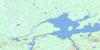
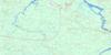
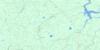
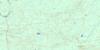
032F01 Lac De La Ligne Topo Map
To view this map, mouse over the map preview on the right.
You can also download this topo map for free:
032F01 Lac De La Ligne high-resolution topo map image.
Maps for the Lac De La Ligne topo map sheet 032F01 at 1:50,000 scale are also available in these versions:
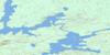
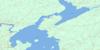
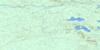
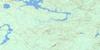
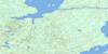
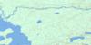
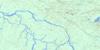
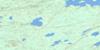
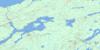
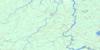
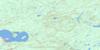
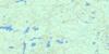
Lac De La Ligne Surrounding Area Topo Maps
 |
 |
 |
 |
 |
 |
 |
 |
 |
 |
 |
 |
 |
 |
 |
 |
© Department of Natural Resources Canada. All rights reserved.
Lac De La Ligne Gazetteer
The following places can be found on topographic map sheet 032F01 Lac De La Ligne:
Lac De La Ligne Topo Map: Geographical areas
CuvillierEffiat
Moquin
Mountain
Muy
Ralleau
Ruette
Souart
Wilson
Lac De La Ligne Topo Map: Lakes
Lac Bear ClawLac Bone
Lac Bouat
Lac de la Ligne
Lac des Cervidés
Lac Descoteaux
Lac du Grog
Lac Labrecque
Lac Muy
Lac Nicole
Lac Normandeau
Lac Novellet
Lac Périgny
Lac Ruette
Lac Sheilann
Lac Square
Lac Stenstrom
Lac Stranded
Lac Villejouin
Lac Wilson
Petit lac de la Ligne
Petit lac Kamishigama
Lac De La Ligne Topo Map: Rivers
Petite rivière WetetnagamiRivière au Panache
Rivière Dazemard
Rivière Muy
Rivière O'Sullivan
Rivière Périgny
Rivière Wetetnagami
Ruisseau des Andouillers
Ruisseau des Dagues
Ruisseau des Épois
Ruisseau des Gouttières
Ruisseau des Merrains
Ruisseau des Meules
Ruisseau des Perches
Ruisseau des Perlures
Ruisseau des Pierrures
Ruisseau Mossant
Ruisseau Mountain

© Department of Natural Resources Canada. All rights reserved.
032F Related Maps:
032F Lac Waswanipi032F01 Lac De La Ligne
032F02 Lac Quevillon
032F03 Passage Du Granite
032F04 Riviere Coigny
032F05 Riviere Des Indiens
032F06 Ile Canica
032F07 Lac Esther
032F08 Lac Pusticamica
032F09 Desmaraisville
032F10 Baie Ramsay
032F11 Riviere Opaoca
032F12 Ile Bancroft
032F13 Matagami
032F14 Lac Olga
032F15 Lac Au Goeland
032F16 Lac Capisisit
