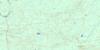
Lac Quevillon Topo Map Online
Download Free Topo Map Sheet 032F02 at 1:50,000 scale
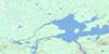
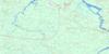
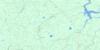
032F02 Lac Quevillon Topo Map
To view this map, mouse over the map preview on the right.
You can also download this topo map for free:
032F02 Lac Quevillon high-resolution topo map image.
Maps for the Lac Quevillon topo map sheet 032F02 at 1:50,000 scale are also available in these versions:
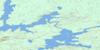
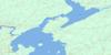
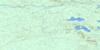
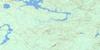
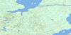
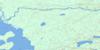
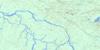
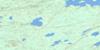
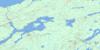
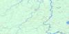
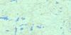
Lac Quevillon Surrounding Area Topo Maps
 |
 |
 |
 |
 |
 |
 |
 |
 |
 |
 |
 |
 |
 |
 |
 |
© Department of Natural Resources Canada. All rights reserved.
Lac Quevillon Gazetteer
The following places can be found on topographic map sheet 032F02 Lac Quevillon:
Lac Quevillon Topo Map: Bays
Baie ÂtiteLac Quevillon Topo Map: City
Lebel-sur-QuévillonLac Quevillon Topo Map: Geographical areas
CuvillierFranquet
Grevet
Holmes
Mountain
Quévillon
Sainte-Famille
Tonnancour
Verneuil
Wilson
Lac Quevillon Topo Map: Islands
Île KamichigamaÎle Kâmicikamak
Lac Quevillon Topo Map: Lakes
Lac ClémentLac Fauvel
Lac Kâkinwâkogamak
Lac Misamiko
Lac Quévillon
Lac Wilson
Petit lac Kamishigama
Lac Quevillon Topo Map: Other municipal/district area - miscellaneous
District judiciaire d'AbitibiLac Quevillon Topo Map: Rapids
Rapide MakoRapide Tcikadjiwan
Lac Quevillon Topo Map: Rivers
Petit ruisseau KinebikRivière Kiask
Rivière Quévillon
Rivière Wedding
Rivière Wilson
Ruisseau Caché
Ruisseau Kâkickigamikisik
Ruisseau Kâkinwânigockwe
Ruisseau Kâwâjak
Ruisseau Kâwânamikowak
Ruisseau Mountain
Ruisseau Wîjina
Lac Quevillon Topo Map: Unincorporated areas
CorribelleCuvillier
Franquet
Lebel-sur-Quévillon
Quévillon

© Department of Natural Resources Canada. All rights reserved.
032F Related Maps:
032F Lac Waswanipi032F01 Lac De La Ligne
032F02 Lac Quevillon
032F03 Passage Du Granite
032F04 Riviere Coigny
032F05 Riviere Des Indiens
032F06 Ile Canica
032F07 Lac Esther
032F08 Lac Pusticamica
032F09 Desmaraisville
032F10 Baie Ramsay
032F11 Riviere Opaoca
032F12 Ile Bancroft
032F13 Matagami
032F14 Lac Olga
032F15 Lac Au Goeland
032F16 Lac Capisisit
