Massif Kucyniak Topo Map Online
Download Free Topo Map Sheet 035C13 at 1:50,000 scale
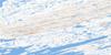
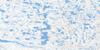
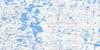
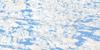
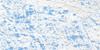
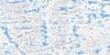
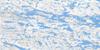
035C13 Massif Kucyniak Topo Map
To view this map, mouse over the map preview on the right.
You can also download this topo map for free:
035C13 Massif Kucyniak high-resolution topo map image.
Maps for the Massif Kucyniak topo map sheet 035C13 at 1:50,000 scale are also available in these versions:
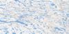
Massif Kucyniak Surrounding Area Topo Maps
 |
 |
 |
 |
 |
 |
 |
 |
 |
 |
 |
 |
 |
 |
 |
 |
© Department of Natural Resources Canada. All rights reserved.
Massif Kucyniak Gazetteer
The following places can be found on topographic map sheet 035C13 Massif Kucyniak:
Massif Kucyniak Topo Map: Bays
Baie KorakBaie Mosquito
Baie Sarvakutaaq
Korak Bay
Mosquito Bay
Massif Kucyniak Topo Map: Capes
Pointe à la SablinePointe Ingiulittuuq
Pointe Morin
Presqu'île Aulassivik
Massif Kucyniak Topo Map: Lakes
Lac AqiaruqLac Bourget
Lac Isiurqutuuq
Lac Lorion
Lac Lumay
Lac Qassituarjuk
Lac Regas
Lac Rusty
Massif Kucyniak Topo Map: Mountains
Cape Smith RangeColline aux Lagopèdes
Colline Pinguq
Massif Kucyniak
Monts D'Youville
Monts d'Youville
Monts Qimiit
Massif Kucyniak Topo Map: Rivers
Rivière ChukotatRivière Iktotat
Rivière Illukotat
Rivière Korak
Ruisseau Qajurtuviup

© Department of Natural Resources Canada. All rights reserved.
035C Related Maps:
035C Povungnituk035C01 Lac Bonnefoy
035C02 Lac Papittukaaq
035C03 Puvirnituq
035C04 Pointe Coutlee
035C05 Pointe Cusson
035C06 Lac Bistodeau
035C07 Lac Quukittuq
035C08 Lac Dumarque
035C09 Riviere Irsuaq
035C10 Lac Tasirjuarusiq
035C11 Lac Akunnimiutaq
035C12 Collines Amajurjuk
035C13E Massif Kucyniak
035C13W Massif Kucyniak
035C14E Lac Isuilutaq
035C14W Lac Isuilutaq
035C15E Lac Koenig
035C15W Lac Koenig
035C16 Lac Bylot
