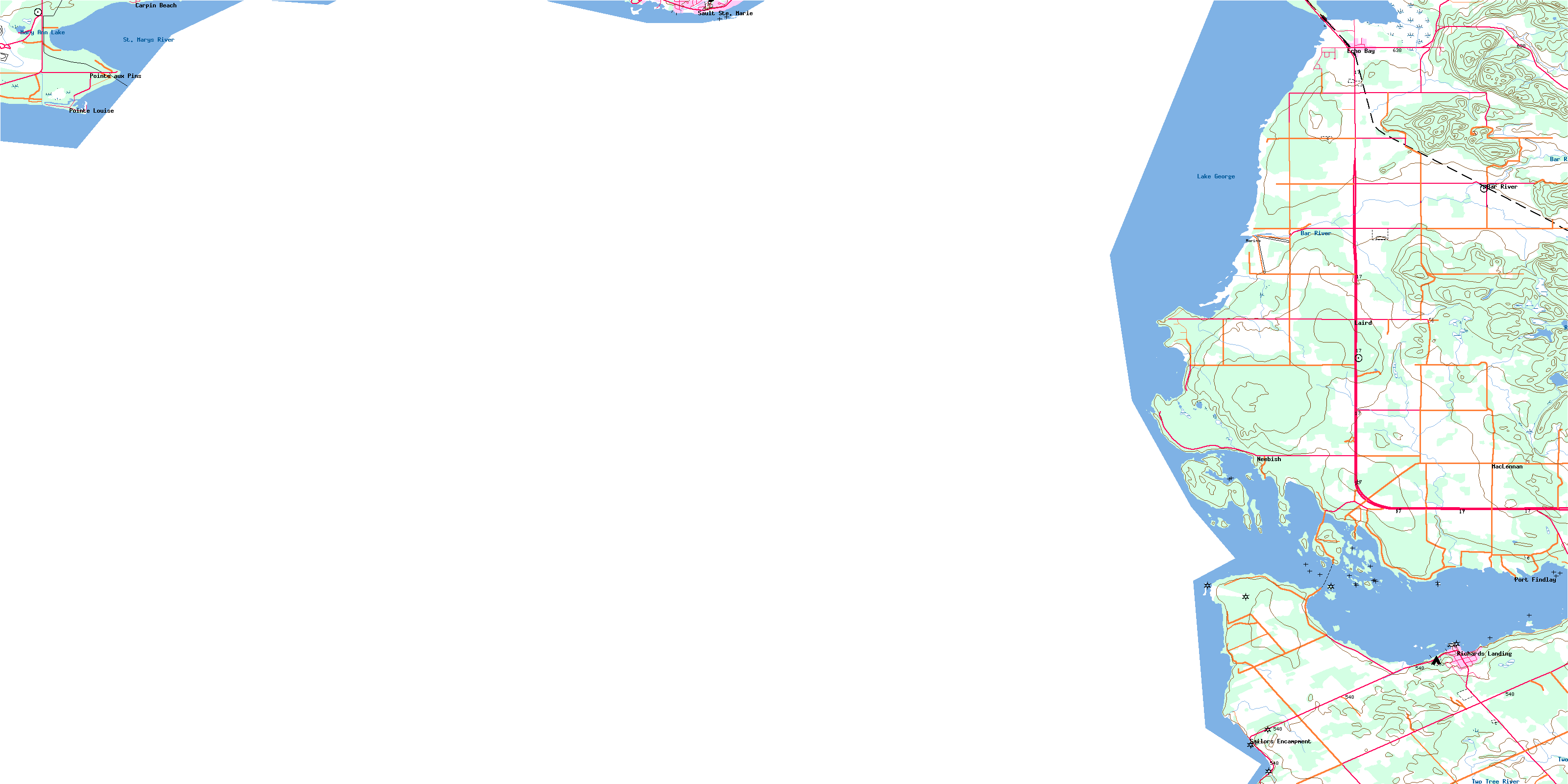
Lake George Topo Map Online
Download Free Topo Map Sheet 041K08 at 1:50,000 scale
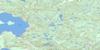
041K08 Lake George Topo Map
To view this map, mouse over the map preview on the right.
You can also download this topo map for free:
041K08 Lake George high-resolution topo map image.
Maps for the Lake George topo map sheet 041K08 at 1:50,000 scale are also available in these versions:
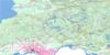
Lake George Surrounding Area Topo Maps
 |
 |
||
 |
 |
||
 |
|||
 |
© Department of Natural Resources Canada. All rights reserved.
Lake George Gazetteer
The following places can be found on topographic map sheet 041K08 Lake George:
Lake George Topo Map: Bays
Brandon HarbourEcho Bay
Marks Bay
Maskinonge Bay
McGregor Bay
Pointe aux Pins Bay
Lake George Topo Map: Capes
Birch PointBoulanger Point
Chicken Point
Coyle Point
Findlay Point
Finlay Point
Green Point
Long Point
Ned Point
Niles Point
Pasture Point
Pointe aux Pins
Pointe des Chênes
Pointe Louise
Pumpkin Point
Reed Point
Stony Point
Stribling Point
Lake George Topo Map: Channels
East Neebish ChannelMunuscong Channel
St. Joseph Channel
Lake George Topo Map: City
Sault Ste. MarieLake George Topo Map: Geographical areas
AlgomaAwenge
Hilton
Jocelyn
Laird
Macdonald
Parke
St. Joseph
Tarbutt
Tarbutt Additional
Lake George Topo Map: Indian Reserves
Garden River Indian Reserve 14Réserve indienne Garden River 14
Lake George Topo Map: Islands
Almon IslandBaschine Island
Bowen Island
Cook Island
Duval Island
East Neebish Island
Foote Island
Forshaw Island
Gaffney Island
Great Maskinonge Island
Hattie Island
Horse Island
Iron Island
Kerby Island
Maskinonge (Pine) Island
Matthews Island
Mayo Island
Neyland Island
Pine Island
Rosseau Island
Sand Island
Sankey Island
Shingwauk Island
Shoal Island
Shoal Islands
St. Joseph Island
Sutton Island
Thorn Island
Toolie Island
Topsail Island
Watson Island
Lake George Topo Map: Lakes
Lake GeorgeMary Ann Lake
Reserve Lake
Lake George Topo Map: Other municipal/district area - miscellaneous
LairdMacdonald, Meredith and Aberdeen Additional
St. Joseph
Tarbutt and Tarbutt Additional
Lake George Topo Map: Rivers
Anderson CreekBar River
Clark Creek
Coulters Creek
Rivière Ste-Marie
Shewfelt Creek
St. Mary River
St. Marys River
Two Tree River
Twotree Creek
Lake George Topo Map: Shoals
Atlantic RockCambria Bank
Chicora Shoal
Cupids Rock
Daniel Shoal
Empire Ledge
Finlay Rock
Hall Shoal
Leonard Reef
McAllister Reef
McGuire Rocks
McKinnon Rock
McLennan Rock
Merida Shoal
Morton Rock
Nanton Reef
Ross Shoal
Rosseau Shoal
Smith Shoal
Vidal Shoals
Wabuno Bank
Waubuno Bank
Whitestone Reef
Lake George Topo Map: Unincorporated areas
Bar RiverCarpin Beach
Echo Bay
Laird
MacLennan
Neebish
Pointe aux Pins
Pointe des Chênes
Pointe des Chênes East
Pointe des Chênes Park
Pointe des Chênes West
Pointe Louise
Port Findlay
Port Finlay
Richards Landing
Sailors Encampment
Sea Gull
© Department of Natural Resources Canada. All rights reserved.
