Grand Rapids Topo Map Online
Download Free Topo Map Sheet 063G03 at 1:50,000 scale
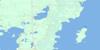
063G03 Grand Rapids Topo Map
To view this map, mouse over the map preview on the right.
You can also download this topo map for free:
063G03 Grand Rapids high-resolution topo map image.
Maps for the Grand Rapids topo map sheet 063G03 at 1:50,000 scale are also available in these versions:
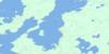
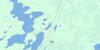
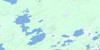
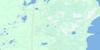
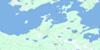
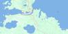
Grand Rapids Surrounding Area Topo Maps
 |
 |
 |
 |
 |
 |
 |
|
 |
 |
||
 |
 |
 |
© Department of Natural Resources Canada. All rights reserved.
Grand Rapids Gazetteer
The following places can be found on topographic map sheet 063G03 Grand Rapids:
Grand Rapids Topo Map: Bays
Cross BayHarbour Bay
Lamb Bay
Portage Bay
Shallow Bay
Grand Rapids Topo Map: Beaches
Sandy BeachGrand Rapids Topo Map: Capes
Aministikoouskok PointBeardy Point
Capstan Point
Colville Point
Jackpine Point
Kanioskeskasik Point
Lopstick Point
Lovers Point
Middle Point
Mission Point
Nistwawnayapiskaw Point
Reef Point
Scots Point
Spruce Point
Ukamasahaw Point
Grand Rapids Topo Map: Hydraulic construction
Grand Rapids Generating StationGrand Rapids Topo Map: Indian Reserves
Grand Rapids 33Grand Rapids Topo Map: Islands
Block IslandPrisoners Island
Grand Rapids Topo Map: Lakes
Beaver Dam LakeCedar Lake
Lac Winnipeg
Lake Winnipeg
Mechiso Lake
Morrison Lake
Grand Rapids Topo Map: Mountains
Baldys BluffsMamowkiyan Ridge
Grand Rapids Topo Map: Conservation areas
Grand Rapids Provincial ParkGrand Rapids Topo Map: Rapids
Cross Lake RapidsGrand Rapids
Redrock Rapids
Grand Rapids Topo Map: Rivers
Eating Point CreekHorn Creek
Rivière Saskatchewan
Saskachaywiak Creek
Saskatchewan River
Grand Rapids Topo Map: Shoals
Saskachayweow BarGrand Rapids Topo Map: Towns
Grand RapidsGrand Rapids Topo Map: Unincorporated areas
Grand RapidsHybord

© Department of Natural Resources Canada. All rights reserved.
