Hollowrock Island Topo Map Online
Download Free Topo Map Sheet 064P12 at 1:50,000 scale
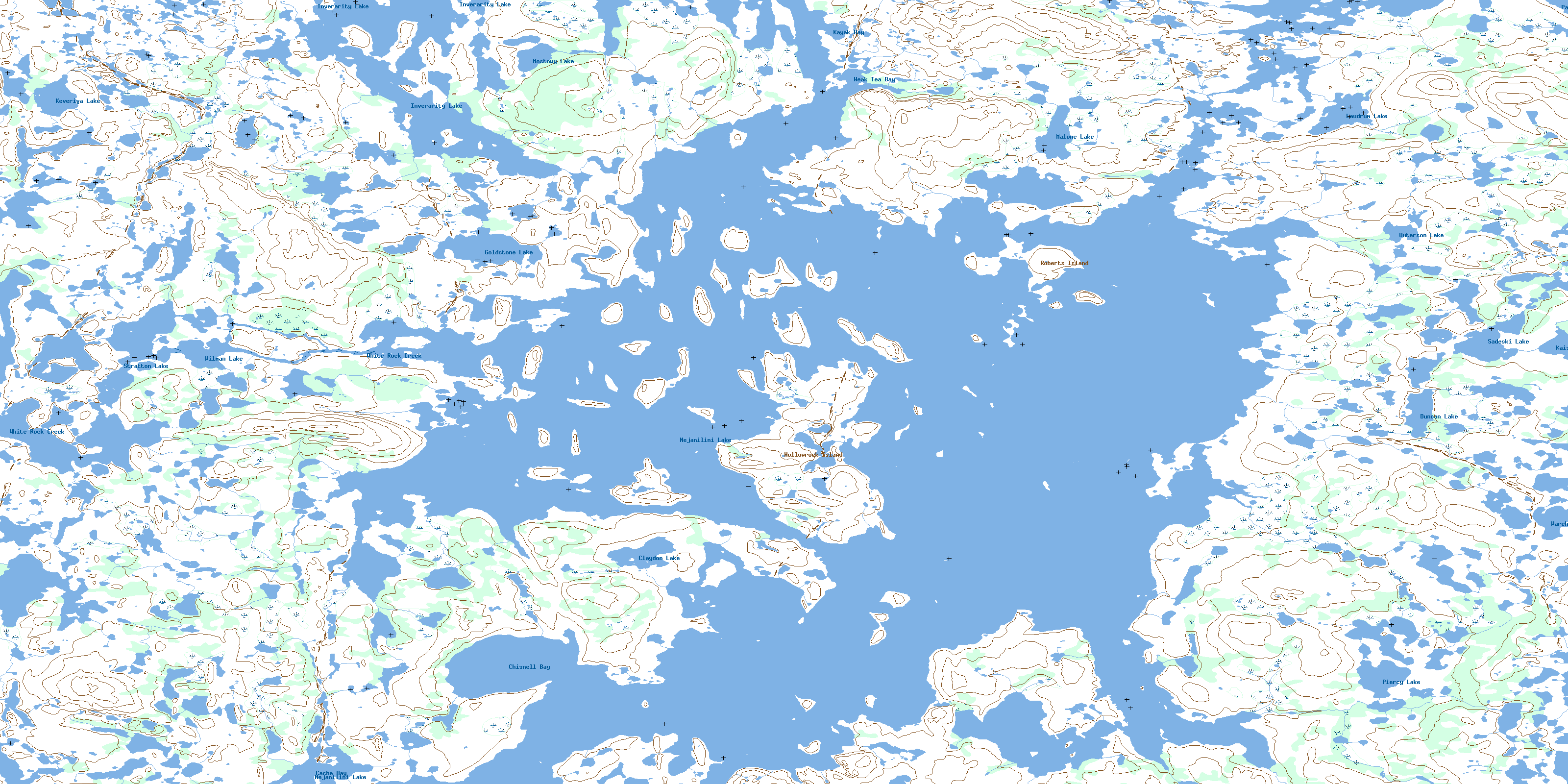
064P12 Hollowrock Island Topo Map
To view this map, mouse over the map preview on the right.
You can also download this topo map for free:
064P12 Hollowrock Island high-resolution topo map image.
Maps for the Hollowrock Island topo map sheet 064P12 at 1:50,000 scale are also available in these versions:
Hollowrock Island Surrounding Area Topo Maps
 |
 |
 |
 |
 |
 |
 |
 |
 |
 |
 |
 |
 |
 |
 |
 |
© Department of Natural Resources Canada. All rights reserved.
Hollowrock Island Gazetteer
The following places can be found on topographic map sheet 064P12 Hollowrock Island:
Hollowrock Island Topo Map: Bays
Cache BayChisnell Bay
Cooper Bay
Crawford Bay
George McKay Bay
Kayak Bay
Parker Bay
Weak Tea Bay
Hollowrock Island Topo Map: Capes
Dixon PointLaw Point
Simmons Peninsula
Weaver Peninsula
Hollowrock Island Topo Map: Islands
Boyle IslandCrawford Island
Ewing Island
Guthrie Island
Hollowrock Island
Ramsay Island
Roberts Island
Shore Island
Stratton Island
Vickers Island
Hollowrock Island Topo Map: Lakes
Claydon LakeDuncan Lake
Goldstone Lake
Inverarity Lake
Kaiser Lake
Keveriga Lake
Laudrum Lake
Malone Lake
Mostowy Lake
Nejanilini Lake
OutersonLake
Palmatier Lake
Piercy Lake
Sadeski Lake
Stratton Lake
Wareham Lake
Wilman Lake
Hollowrock Island Topo Map: Mountains
Allen HillWatson Hill
Hollowrock Island Topo Map: Conservation areas
Caribou River Park ReserveHollowrock Island Topo Map: Rivers
White Rock CreekWolverine River
© Department of Natural Resources Canada. All rights reserved.
064P Related Maps:
064P Nejanilini Lake064P01 Hebner Lake
064P02 Kesselman Lake
064P03 Sellar Lake
064P04 Macleod Lake
064P05 Little Duck Lake
064P06 Fallis Lake
064P07 Wallbridge Lake
064P08 Caribou Lake
064P09 Kellas Lake
064P10 Adam Creek
064P11 Abbott Lake
064P12 Hollowrock Island
064P13 Wakefield Lake
064P14 Commonwealth Lake
064P15 Vickery Lake
064P16 Nabel Lake
