Asquith Topo Map Online
Download Free Topo Map Sheet 073B03 at 1:50,000 scale
073B03 Asquith Topo Map
To view this map, mouse over the map preview on the right.
You can also download this topo map for free:
073B03 Asquith high-resolution topo map image.
Maps for the Asquith topo map sheet 073B03 at 1:50,000 scale are also available in these versions:
Asquith Surrounding Area Topo Maps
 |
 |
 |
 |
 |
 |
 |
 |
 |
 |
 |
 |
 |
 |
 |
 |
© Department of Natural Resources Canada. All rights reserved.
Asquith Gazetteer
The following places can be found on topographic map sheet 073B03 Asquith:
Asquith Topo Map: Lakes
Rice LakeAsquith Topo Map: Other municipal/district area - miscellaneous
Corman Park No. 344Eagle Creek No. 376
Park No. 375
Perdue No. 346
Vanscoy No. 345
Asquith Topo Map: Conservation areas
Eagle Creek Regional ParkAsquith Topo Map: Rivers
Dry CreekEagle Creek
Asquith Topo Map: Towns
AsquithAsquith Topo Map: Unincorporated areas
AsquithDunfermline
Environ
Hawoods
Juniata
Rhyl
Urban
Vade
Asquith Topo Map: Villages
Kinley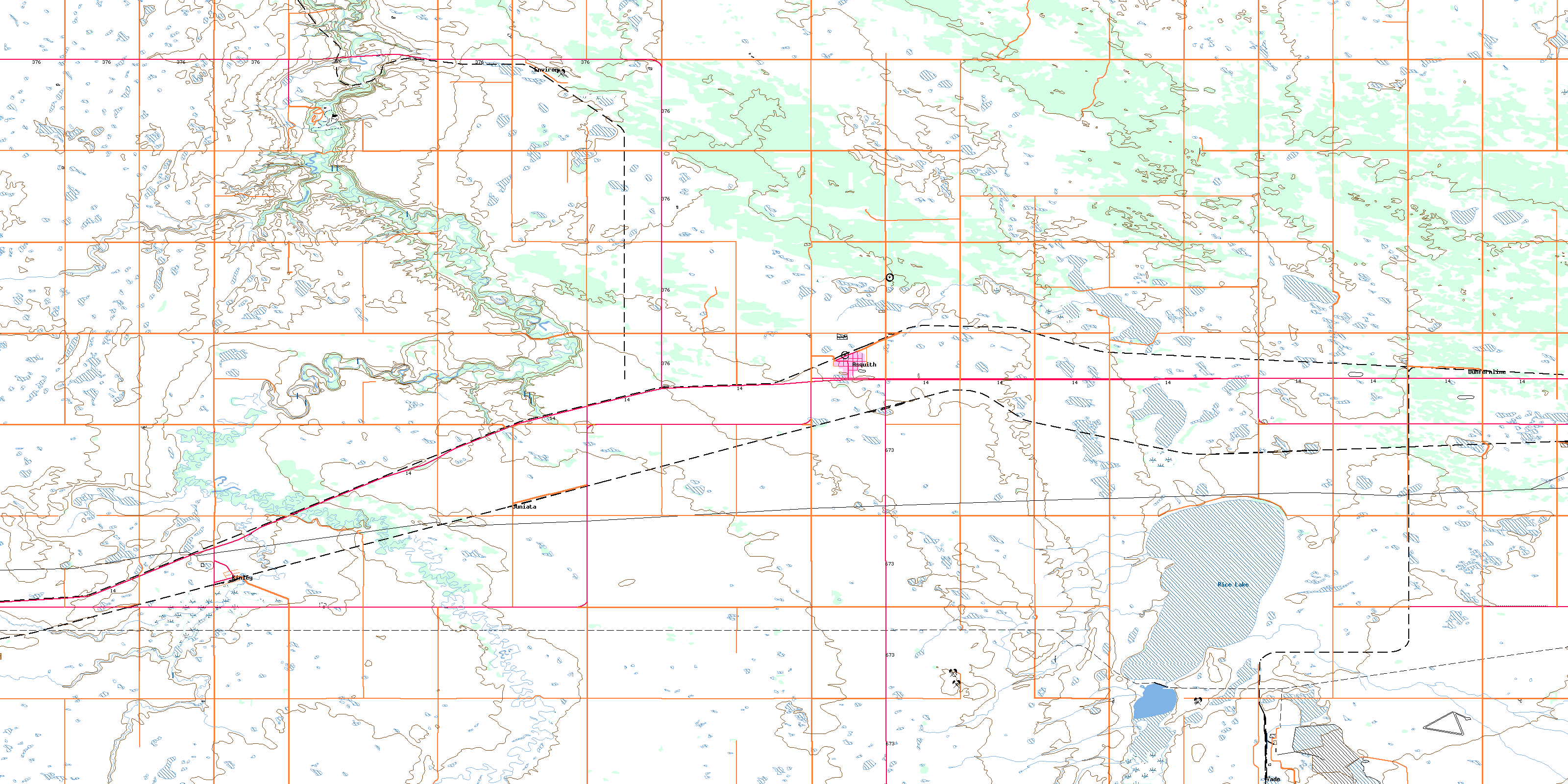
© Department of Natural Resources Canada. All rights reserved.
