Namu Topo Map Online
Download Free Topo Map Sheet 092M13 at 1:50,000 scale
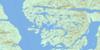
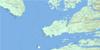
092M13 Namu Topo Map
To view this map, mouse over the map preview on the right.
You can also download this topo map for free:
092M13 Namu high-resolution topo map image.
Maps for the Namu topo map sheet 092M13 at 1:50,000 scale are also available in these versions:
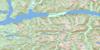
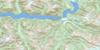
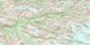
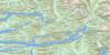
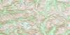
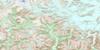
Namu Surrounding Area Topo Maps
 |
 |
 |
 |
 |
 |
 |
 |
 |
 |
 |
 |
 |
 |
 |
 |
© Department of Natural Resources Canada. All rights reserved.
Namu Gazetteer
The following places can be found on topographic map sheet 092M13 Namu:
Namu Topo Map: Bays
Fougner BayHarlequin Basin
Kisameet Bay
Kiwash Cove
Namu Harbour
Rock Inlet
Warrior Cove
Whirlwind Bay
Windsor Cove
Namu Topo Map: Capes
Campbell PointDe Cosmos Point
DeCosmos Point
Edmund Point
Haaksvold Point
Hvidsten Point
Koeye Point
Middleton Point
Ontario Point
Uganda Point
Walker Point
Namu Topo Map: Channels
Burke ChannelCloverleaf Passage
Fisher Channel
Fitz Hugh Sound
Morehouse Passage
North Passage
Namu Topo Map: Indian Reserves
Kisameet Indian Reserve 7Réserve indienne Kisameet 7
Namu Topo Map: Islands
Calvert IslandClam Island
Cliff Island
Humchitt Island
Hunter Island
King Island
Kipling Island
Kisameet Islands
Kiwash Island
Lapwing Island
Nalau Island
Sagen Islet
Sunday Island
Verdant Island
Namu Topo Map: Lakes
Cranberry LakeDe Cosmos Lagoon
DeCosmos Lagoon
Draney Lakes
Gildersleve Lake
Kisameet Lake
Koeye Lake
Little Koeye Lake
Namu Lake
Osborne Lake
Namu Topo Map: Mountains
Chaîne CôtièreCoast Mountains
Kitimat Ranges
Koeye Range
Namu Range
Pacific Ranges
Namu Topo Map: Major municipal/district area - major agglomerations
Central Coast Regional DistrictNamu Topo Map: Conservation areas
Hakai Conservation Study AreaHakai Recreation Area
Namu Topo Map: Rivers
Amy CreekCold Creek
Doc Creek
Doris Creek
Koeye River
MacNair Creek
Namu River
Nootum River
Quatlena River
Third Creek
West Inrig Creek
Namu Topo Map: Shoals
Fog RocksLoo Rock
Que Que Rock
Que Que Rocks
Namu Topo Map: Unincorporated areas
Namu
© Department of Natural Resources Canada. All rights reserved.
092M Related Maps:
092M Rivers Inlet092M01 Atwaykellesse River
092M02 Seymour Inlet
092M03 Belize Inlet
092M04 Cape Caution
092M05 Goose Bay
092M06 Smith Inlet
092M07 Mount Philley
092M08 Catto Creek
092M09 Machmell River
092M10 Owikeno Lake
092M11 Rivers Inlet
092M12 Fish Egg Inlet
092M13 Namu
092M14 Kilbella River
092M15 Tzeo River
092M16 Sheemahant River
