Goose Bay Topo Map Online
Download Free Topo Map Sheet 092M05 at 1:50,000 scale
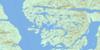
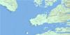
092M05 Goose Bay Topo Map
To view this map, mouse over the map preview on the right.
You can also download this topo map for free:
092M05 Goose Bay high-resolution topo map image.
Maps for the Goose Bay topo map sheet 092M05 at 1:50,000 scale are also available in these versions:
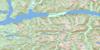
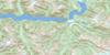
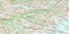
Goose Bay Surrounding Area Topo Maps
 |
 |
 |
 |
 |
 |
 |
 |
 |
 |
 |
 |
 |
 |
 |
 |
© Department of Natural Resources Canada. All rights reserved.
Goose Bay Gazetteer
The following places can be found on topographic map sheet 092M05 Goose Bay:
Goose Bay Topo Map: Bays
Anchor BightAngle Bay
Big Frypan Bay
Bleak Bay
Boswell Inlet
Broad Bay
Bull Cove
Canoe Cove
Chic Chic Bay
Draney Inlet
Dsulish Bay
Eliza Bay
Ethel Cove
Exposed Anchorage
Finis Nook
Finn Bay
Fishhook Bay
Fly Basin
Frigate Bay
Frypan Bay
Geetla Inlet
Goose Bay
Grief Bay
Home Bay
Hook Bay
Johnston Bay
Kelp Bay
Leroy Bay
Lucy Bay
Margaret Bay
McBride Bay
Millbrook Cove
Open Bight
Queen Charlotte Sound
Rivers Inlet
Robert Arm
Rocky Bay
Schooner Retreat
Secure Anchorage
Smith Inlet
Smith Sound
Sunshine Bay
Takush Harbour
Taylor Bay
Wilson Bay
Goose Bay Topo Map: Capes
Abrupt PointBarb Point
Bay Point
Birkby Point
Bloxam Point
Bull Point
Canniff Point
Cape Calvert
Clark Point
Crabpot Point
Cranstown Point
Curlew Point
Cypress Point
Dimsey Point
Extended Point
Fly Point
Fury Point
Geetla Point
Gikumi Point
Harold Point
Karslake Point
Kelp Head
Limit Point
Mills Point
North Point
Olive Point
Ripon Point
Rouse Point
Spit Point
Stormy Point
Sulky Point
Surf Point
Wakas Point
Goose Bay Topo Map: Channels
Ahclakerho ChannelAlexandra Passage
Beaver Passage
Blackney Channel
Breaker Passage
Browning Channel
Darby Channel
Draney Narrows
Edmund Passage
Fitz Hugh Sound
Irving Passage
Klaquaek Channel
Loran Passage
Magee Channel
North Passage
Radar Passage
Safe Entrance
Ship Passage
South Passage
Verney Passage
Goose Bay Topo Map: Cliffs
Sea BluffGoose Bay Topo Map: Indian Reserves
Ann Island Indian Reserve 7Nathlegalis Indian Reserve 3
Réserve indienne Ann Island 7
Réserve indienne Nathlegalis 3
Goose Bay Topo Map: Islands
Anchor IsletsAnn Island
Bar Islands
Barrier Group
Barrier Islands
Bat Island
Bay Islands
Bilton Island
Bird Island
Bright Islets
Brodie Island
Broken Islands
Brown Island
Bull Island
Calf Islet
Calvert Island
Cathcart Island
Central Island
Centre Island
Chambers Island
Charles Island
Charley Islands
Chest Island
Cleve Island
Cow Island
Crooked Island
Curry Islet
Denison Island
Drumrock Island
Dsulish Island
Dudley Islet
Dyer Islands
Dyer Islets
Egg Island
False Egg Island
Fire Island
Fire Islets
Folly Island
Folly Islet
Frigate Islet
Fury Island
Gnarled Islets
Greaves Island
Green Island
Grey Islets
Halliday Island
Harbour Island
Haystack Island
Hazel Island
Heathcote Island
Highway Island
Highway Islands
Indian Island
Ironside Island
Jagged Islands
Joachim Island
Leroy Island
Maze Islands
Maze Islets
Moss Islands
Napier Island
Oblong Island
O'Neil Islet
Oval Island
Penrose Island
Ripon Island
Round Island
Search Islands
Sharbau Island
Shield Island
Shower Island
Sorrow Islands
Sound Island
Stunted Islets
Surf Islets
Table Island
Tie Island
Turner Islands
Walbran Island
Watcher Islands
Wooded Islet
Goose Bay Topo Map: Lakes
Bjune LakeDeer Lake
Finn Lake
Gordon Lake
Gordon Lakes
Hagen Lake
Leroy Lake
Mynnti Lake
Goose Bay Topo Map: Mountains
Base HillCape Range
Chaîne Côtière
Coast Cone
Coast Mountains
East Hill
Entry Cone
Flat Mountain
Mount Rivers
Pacific Ranges
Quoin Hill
Sharp Hill
Goose Bay Topo Map: Major municipal/district area - major agglomerations
Central Coast Regional DistrictRegional District of Mount Waddington
Goose Bay Topo Map: Conservation areas
Penrose Island Marine ParkGoose Bay Topo Map: Rivers
Bjune CreekBoss Creek
Hagen Creek
Hogan Creek
Johnston Creek
Mynnti Creek
Takush River
Goose Bay Topo Map: River features
Broad ReachGoose Bay Topo Map: Shoals
Ada RockArmstrong Rock
Barry Rock
Bertie Rock
Brown Bank
Camosun Rock
Canoe Rocks
Chance Rock
Cluster Reefs
Comber Rock
Dugout Rocks
Dyer Rock
Edward Rock
England Rock
Fish Rocks
Frank Rock
Hawser Rock
Henderson Shoal
James Rock
John Rock
Judd Rock
Leroy Rock
Major Brown Rock
Mamie Rock
Maud Rock
Middle Patch
Millbrook Rocks
Nab Patch
One Foot Rock
O'Neil Rock
Paddle Rock
Petrel Shoal
Round Rock
Rouse Reef
Ruby Rocks
Ship Rock
Silistria Shoal
Speedwell Shoal
Spur Rocks
Staunton Shoal
Surprise Patch
Thorndike Shoal
Walrus Rock
White Rocks
Wood Rocks
Zero Rock
Goose Bay Topo Map: Unincorporated areas
BoswellDuncanby Landing
Goose Bay
© Department of Natural Resources Canada. All rights reserved.
092M Related Maps:
092M Rivers Inlet092M01 Atwaykellesse River
092M02 Seymour Inlet
092M03 Belize Inlet
092M04 Cape Caution
092M05 Goose Bay
092M06 Smith Inlet
092M07 Mount Philley
092M08 Catto Creek
092M09 Machmell River
092M10 Owikeno Lake
092M11 Rivers Inlet
092M12 Fish Egg Inlet
092M13 Namu
092M14 Kilbella River
092M15 Tzeo River
092M16 Sheemahant River
