100 Mile House Topo Map Online
Download Free Topo Map Sheet 092P11 at 1:50,000 scale
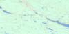
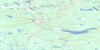
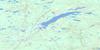
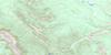
092P11 100 Mile House Topo Map
To view this map, mouse over the map preview on the right.
You can also download this topo map for free:
092P11 100 Mile House high-resolution topo map image.
Maps for the 100 Mile House topo map sheet 092P11 at 1:50,000 scale are also available in these versions:
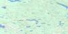
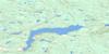
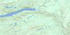
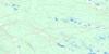
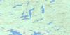
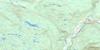
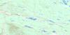
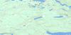
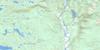
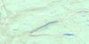
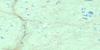
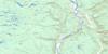
100 Mile House Surrounding Area Topo Maps
 |
 |
 |
 |
 |
 |
 |
 |
 |
 |
 |
 |
 |
 |
 |
 |
© Department of Natural Resources Canada. All rights reserved.
100 Mile House Gazetteer
The following places can be found on topographic map sheet 092P11 100 Mile House:
100 Mile House Topo Map: District municipality
100 Mile House100 Mile House Topo Map: Geographical areas
Interlakes100 Mile House Topo Map: Indian Reserves
Canim Lake Indian Reserve 2Réserve indienne Canim Lake 2
100 Mile House Topo Map: Lakes
101 Mile Lake103 Mile Lake
105 Mile Lake
108 Mile Lake
Abbs Lake
Abel Lake
Alans Lake
Big Lake
Buffalo Lake
Camel Lake
Carment Lakes
Chicken Lake
Chris Lake
Davis Lake
Davy Lake
Disputed Lakes
Earle Lake
Edmund Lake
Edwards Lake
Elliot Lake
Exeter Lake
Fiset Lake
Foxtail Lake
Guessagain Lake
Gwenie Lake
Hartwig Lake
Horse Lake
Irish Lake
Jack Frost Lake
Keith Lake
Kelsey Lake
Lily Pad Lake
Lilyleaf Lake
Longbow Lake
McKinlay Lake
Milch Lake
Milch Lakes
Mirage Lake
Mud Lake
Parting Lake
Parting Lakes
Quinn Lake
Roundup Lake
Savon Lake
Scout Lake
Sepa Lake
Simon Lake
Stephenson Lake
Straight Lake
Tad Lake
Tatton Lake
Trapping Lake
Valentine Lake
Watson Lake
Wildhorse Lake
100 Mile House Topo Map: Mountains
Huckleberry ButteLone Butte
100 Mile House Topo Map: Major municipal/district area - major agglomerations
Cariboo Regional District100 Mile House Topo Map: Plains
Fraser PlateauInterior Plateau
100 Mile House Topo Map: Rivers
Attwood CreekBuffalo Creek
Chicken Creek
Eightyseven Creek
Evergreen Creek
Fawn Creek
Foxtail Creek
Halfway Creek
Little Bridge Creek
Longbow Creek
Ninetythree Mile Creek
Ravine Creek
Rock Creek
Simon Creek
Tatton Creek
Upper Willowdale Creek
Watch Creek
Watson Creek
100 Mile House Topo Map: Unincorporated areas
105 Mile House108 Mile House
108 Mile Ranch
87 Mile House
93 Mile
Buffalo Creek
Canim
Eightyseven Mile House
Exeter
Fawn
Gateway
Lone Butte
Potter
Tatton
Willowford
100 Mile House Topo Map: Valleys
Walker Valley
© Department of Natural Resources Canada. All rights reserved.
092P Related Maps:
092P Bonaparte Lake092P01 Louis Creek
092P02 Criss Creek
092P03 Loon Lake
092P04 Clinton
092P05 Jesmond
092P06 Green Lake
092P07 Bridge Lake
092P08 Chu Chua Creek
092P09 Clearwater
092P10 Deka Lake
092P11 100 Mile House
092P12 Gustafsen Lake
092P13 Chimney Lake
092P14 Lac La Hache
092P15 Canim Lake
092P16 Mahood Lake
