Kittigazuit Topo Map Online
Download Free Topo Map Sheet 107C07 at 1:50,000 scale
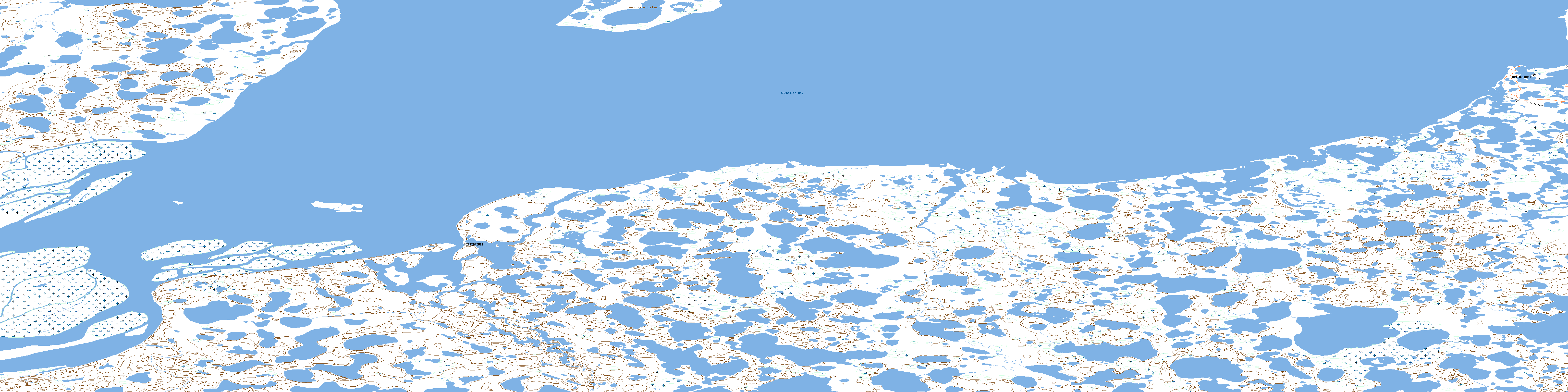
107C07 Kittigazuit Topo Map
To view this map, mouse over the map preview on the right.
You can also download this topo map for free:
107C07 Kittigazuit high-resolution topo map image.
Maps for the Kittigazuit topo map sheet 107C07 at 1:50,000 scale are also available in these versions:
Kittigazuit Surrounding Area Topo Maps
 |
 |
 |
 |
 |
 |
 |
 |
 |
 |
 |
 |
© Department of Natural Resources Canada. All rights reserved.
Kittigazuit Gazetteer
The following places can be found on topographic map sheet 107C07 Kittigazuit:
Kittigazuit Topo Map: Bays
Canyanek InletKidluit Bay
Kittigazuit Bay
Kugmallit Bay
Kittigazuit Topo Map: Capes
Flagpole PointMackenzie Delta
Naparotalik Spit
Peninsula Point
Ptarmigan Point
Skiff Point
Kittigazuit Topo Map: Channels
Western EntranceKittigazuit Topo Map: Hamlets
TuktoyaktukKittigazuit Topo Map: Islands
Conn IslandHendrickson Island
Richards Island
Tuktoyaktuk Island
Kittigazuit Topo Map: Lakes
Ice LakeTareoknitok Lagoon
Kittigazuit Topo Map: Mountains
Ibyuk PingoSplit Pingo
Whitefish Pingo
Kittigazuit Topo Map: Rivers
Fleuve MackenzieMackenzie River
Kittigazuit Topo Map: Seas
Beaufort SeaMer de Beaufort
Kittigazuit Topo Map: Shoals
Beluga ReefKittigazuit Topo Map: Territory
Northwest TerritoriesTerritoires du Nord-Ouest
Kittigazuit Topo Map: Unincorporated areas
KittigazuitPort Brabant
Whitefish Station
© Department of Natural Resources Canada. All rights reserved.
107C Related Maps:
107C Mackenzie Delta107C01E No Title
107C01W No Title
107C02E No Title
107C02W No Title
107C03E Tununuk
107C03W Tununuk
107C04E Ellice Island
107C04W Ellice Island
107C05E Garry Island
107C05W Garry Island
107C06E Denis High Hill
107C06W Denis High Hill
107C07E Kittigazuit
107C07W Kittigazuit
107C08E No Title
107C08W No Title
107C09E Hutchison Bay
107C09W Hutchison Bay
107C10W Kidluit Bay
107C11E Hansen Harbour
107C11W Hooper Island
107C12E Pelly Island
107C12W Pelly Island
