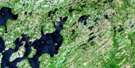
Tug Pond Satellite Image Map
Download Free Aerial Photo 002D01 at 1:50,000 scale
Tug Pond Satellite Imagery
To view this satellite map, mouse over the air photo on the right.
You can also download this satellite image map for free:
002D01 Tug Pond high-resolution satellite image map.
Maps for the Tug Pond aerial map sheet 002D01 at 1:50,000 scale are also available in these versions:
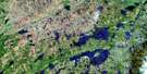
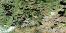
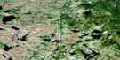
Tug Pond Surrounding Area Aerial Photo Maps
 |
 |
 |
 |
 |
 |
 |
 |
 |
 |
 |
 |
 |
 |
 |
 |
© Department of Natural Resources Canada. All rights reserved.
Tug Pond Gazetteer
The following places can be found on satellite image map 002D01 Tug Pond:
Tug Pond Satellite Image: Lakes
Andrews PondBig Pond
Black River Pond
Frost Pond
Goose Pond
Hornet Pond
Island Pond
Island Pond
Lynx Pond
Maxs Pond
Middle Pond
Norsemans Pond
Ocean Pond
Red Indian Pond
Rocky Pond
Shoal Harbour Pond
Sleigh Pond
Sugar Pond
Tug Pond
Western Pond
Whitehead Pond
Tug Pond Satellite Image: Conservation areas
Bay du Nord Wilderness ReserveNewfoundland T'Railway Provincial Park
Tug Pond Satellite Image: Rivers
Black BrookDark Hole Brook
Deep Bight River
Georges Brook
Lower Shoal Harbour River
Northwest Brook
Pipers Hole River
Red River
Shoal Harbour River
Southwest River
Tug Pond Satellite Image: Towns
ClarenvilleTug Pond Satellite Image: Unincorporated areas
Northern BightRioux
© Department of Natural Resources Canada. All rights reserved.
002D Related Maps:
002D Gander Lake002D01 Tug Pond
002D02 Meta Pond
002D03 Mount Sylvester
002D04 Twillick Brook
002D05 Burnt Hill
002D06 Great Gull Lake
002D07 Kepenkeck Lake
002D08 Port Blandford
002D09 Glovertown
002D10 Dead Wolf Pond
002D11 Eastern Pond
002D12 Miguels Lake
002D13 Grand Falls
002D14 Mount Peyton
002D15 Gander
002D16 Gambo
