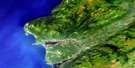
La Poile River Satellite Image Map
Download Free Aerial Photo 011O16 at 1:50,000 scale
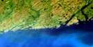
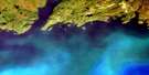
La Poile River Satellite Imagery
To view this satellite map, mouse over the air photo on the right.
You can also download this satellite image map for free:
011O16 La Poile River high-resolution satellite image map.
Maps for the La Poile River aerial map sheet 011O16 at 1:50,000 scale are also available in these versions:
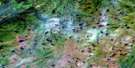
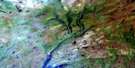
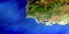
La Poile River Surrounding Area Aerial Photo Maps
 |
 |
 |
|
 |
 |
 |
|
© Department of Natural Resources Canada. All rights reserved.
La Poile River Gazetteer
The following places can be found on satellite image map 011O16 La Poile River:
La Poile River Satellite Image: Bays
Bakers CoveDolman Cove
North Bay
Northeast Arm
La Poile River Satellite Image: Capes
Bakers SpitBirchey Head
Dolman Head
La Poile River Satellite Image: Channels
The NarrowsLa Poile River Satellite Image: Lakes
Big Otter PondBig Pond
Bolt Pond
Cooks Pond
Lake Margaret
Mouse Pond
Rocky Ridge Pond
Strickland Pond
Trout Pond
Wiggly Pond
La Poile River Satellite Image: Mountains
Baggs HillBarnes Hill
Bennett Hill
Berteau Hill
Eastern Fox Hill
Eastern Gunflap Hill
Eight Mile Hill
Inner Gunflap Hill
Long Range Mountains
Rocky Ridge
Western Fox Hill
Western Gunflap Hill
La Poile River Satellite Image: Rivers
Ackerman BrookBakers Brook
Big Pond Brook
Broad Cove Brook
Bunker Hill Brook
Burke Brook
Carrot Brook
Cascade Brook
Cinq Cerf Brook
Couteau Brook
Deep Brook
East Bay Brook
Farmers Brook
Fox Hole Brook
Garia Brook
Gooseberry Brook
La Poile River
Mitchells Brook
Morg Keepings Brook
Mouse Pond Brook
Northwest Brook
Phillips Brook
Rattling Brook
Rocky Ridge Brook
Round Hill Brook
Salmon Hole Brook
Two Way Brook
Woody Brook
La Poile River Satellite Image: Unincorporated areas
East BayNorth Bay
La Poile River Satellite Image: Valleys
Cross Gulch
© Department of Natural Resources Canada. All rights reserved.
