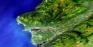
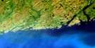
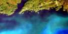
Grandys Lake Satellite Image Map
Download Free Aerial Photo 011O15 at 1:50,000 scale
Grandys Lake Satellite Imagery
To view this satellite map, mouse over the air photo on the right.
You can also download this satellite image map for free:
011O15 Grandys Lake high-resolution satellite image map.
Maps for the Grandys Lake aerial map sheet 011O15 at 1:50,000 scale are also available in these versions:
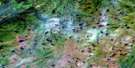
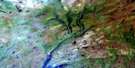
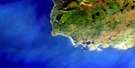
Grandys Lake Surrounding Area Aerial Photo Maps
 |
 |
 |
|
 |
 |
 |
|
© Department of Natural Resources Canada. All rights reserved.
Grandys Lake Gazetteer
The following places can be found on satellite image map 011O15 Grandys Lake:
Grandys Lake Satellite Image: Lakes
Burnt Island PondDingwells Pond
Doughball Pond
Eddies Pond
Gillams Pond
Grandys Lake
Hammonds Pond
Kangaroo Pond
Long Pond
Moose Pond
Sandy Pond
Sandy Pond
Star Pond
Grandys Lake Satellite Image: Mountains
Long Range MountainsStag Hill
Grandys Lake Satellite Image: Conservation areas
Newfoundland T'Railway Provincial ParkGrandys Lake Satellite Image: Rivers
Garia BrookGrandys Brook
Isle aux Morts River
Johns Brook
Little Codroy River
Mollichignick Brook
Muises Brook
North Branch
Northwest Brook
Northwest Brook
Rose Blanche Brook
South Branch
Stephens Brook
Grandys Lake Satellite Image: Unincorporated areas
Coal Brook
© Department of Natural Resources Canada. All rights reserved.
