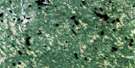
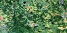
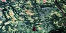
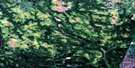
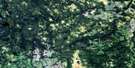
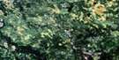
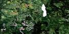
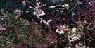
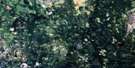
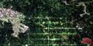
Villebois Satellite Image Map
Download Free Aerial Photo 032E03 at 1:50,000 scale
Villebois Satellite Imagery
To view this satellite map, mouse over the air photo on the right.
You can also download this satellite image map for free:
032E03 Villebois high-resolution satellite image map.
Maps for the Villebois aerial map sheet 032E03 at 1:50,000 scale are also available in these versions:
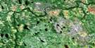
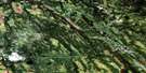
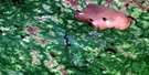
Villebois Surrounding Area Aerial Photo Maps
 |
 |
 |
 |
 |
 |
 |
 |
 |
 |
 |
 |
 |
 |
 |
 |
© Department of Natural Resources Canada. All rights reserved.
Villebois Gazetteer
The following places can be found on satellite image map 032E03 Villebois:
Villebois Satellite Image: Bays
Baie KinojeaminikamiBaie Kohokoho
Baie Nidokwagan
Baie Nigigami
Villebois Satellite Image: Miscellaneous campsites
Jupiter-30Jupiter-Trente
Villebois Satellite Image: Capes
Pointe TagwagiciVillebois Satellite Image: Channels
Passage ObadawagaVillebois Satellite Image: Geographical areas
BoivinChazel
Clermont
Des Méloizes
Lavergne
Lemaire
Paradis
Perron
Rousseau
Saint-Camille
Saint-Éphrem
Saint-Joachim
Villebois Satellite Image: Islands
Île CagawapaniÎle Ikodjic
Île Kaicpabikinaga
Île Kakinwanaga
Île Kawigwasiginaga
Île Saban
Villebois Satellite Image: Lakes
Lac AldasLac Altona
Lac Altura
Lac Calamité
Lac Des Méloizes
Lac des Montagnes
Lac Domède
Lac Domène
Lac Imbeau
Lac Jos-Doire
Lac Oloron
Lac Pajegasque
Lac Poison
Lac Trout
Lac Turgeon
Lac Vert
Nigigwadinibi
Villebois Satellite Image: Mountains
Collines AbitibiCollines Fenouillet
Villebois Satellite Image: Major municipal/district area - major agglomerations
Abitibi-OuestVillebois Satellite Image: Other municipal/district area - miscellaneous
Rivière-OjimaVillebois Satellite Image: Rapids
Rapide KamiskawanamebinesiwagVillebois Satellite Image: Rivers
Branche BlanchardBranche Bradette
Branche Dufour
Branche Harvey
Branche Leblanc
Branche Lépine
Branche Noël
Branche Paiement
Branche Pearson
Branche Pilote
Branche Plourde
Branche Savard-Harvey
Branche Sivrais
Branche St-Amand
Branche Tremblay
Branche Vandal
Cours d'eau Aubé
Cours d'eau Belisle
Cours d'eau Belzil
Cours d'eau Bergeron
Cours d'eau Blais
Cours d'eau Boisvert
Cours d'eau Boivin
Cours d'eau Bouchard
Cours d'eau Boucher
Cours d'eau Boulet
Cours d'eau Clermont
Cours d'eau Côté
Cours d'eau Desgagné
Cours d'eau Desrochers
Cours d'eau Doire
Cours d'eau Fortin
Cours d'eau Gagnon
Cours d'eau Gauthier
Cours d'eau Girard
Cours d'eau Goulet
Cours d'eau Grenon
Cours d'eau Larouche
Cours d'eau Lavoie
Cours d'eau Lucien
Cours d'eau Mailloux
Cours d'eau Maltais
Cours d'eau Matte
Cours d'eau Ménard
Cours d'eau Meunier
Cours d'eau Moreau
Cours d'eau Morin
Cours d'eau Nadeau
Cours d'eau Ouellet
Cours d'eau Paquette
Cours d'eau Piché
Cours d'eau Poulin
Cours d'eau Prud'Homme
Cours d'eau Rousseau
Cours d'eau Sauvageau
Cours d'eau Servant
Cours d'eau Simard
Cours d'eau Taché
Cours d'eau Tanguay
Cours d'eau Thibeault
Cours d'eau Tremblay
Cours d'eau Trudeau
Name Sibi
Rivière Boivin
Rivière Calamité
Rivière Des Méloizes
Rivière Hannah
Rivière Hurricanaw
Rivière Lavergne
Rivière Ménard
Rivière Pajegasque
Rivière Turgeon
Ruisseau Grenier
Ruisseau Hal
Ruisseau Kodiga
Ruisseau Leslie
Villebois Satellite Image: River features
Coude KaodoskwanisegVillebois Satellite Image: Road features
Pont des PionniersPont des Souvenirs
Pont Maurice-Duplessis
Pont Taschereau
Villebois Satellite Image: Unincorporated areas
BeaucantonBeaucanton
Rivière-Turgeon
Val-Paradis
Val-Paradis
Villebois
Villebois
Villebois Satellite Image: Villages
ClermontNormétal
Saint-Lambert
Val-Saint-Gilles

© Department of Natural Resources Canada. All rights reserved.
032E Related Maps:
032E Joutel032E01 Mont Douaumont
032E02 Mont Plamondon
032E03 Villebois
032E04 Abbotsford Lake
032E05 Payntouk Lake
032E06 Ruisseau Orfroy
032E07 Lac Mistaouac
032E08 Ruisseau Kistabiche
032E09 Lac Laurin
032E10 Lac Newiska
032E11 Lac Raymond
032E12 Chabbie Lake
032E13 Detour Lake
032E14 Riviere Turgeon
032E15 Collines Gaudet
032E16 Lac Grasset
