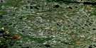
Stromness Island Satellite Image Map
Download Free Aerial Photo 033E14 at 1:50,000 scale
Stromness Island Satellite Imagery
To view this satellite map, mouse over the air photo on the right.
You can also download this satellite image map for free:
033E14 Stromness Island high-resolution satellite image map.
Maps for the Stromness Island aerial map sheet 033E14 at 1:50,000 scale are also available in these versions:
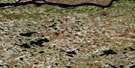
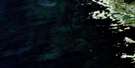
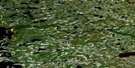
Stromness Island Surrounding Area Aerial Photo Maps
 |
 |
 |
|
 |
 |
 |
|
 |
 |
 |
|
 |
 |
 |
© Department of Natural Resources Canada. All rights reserved.
Stromness Island Gazetteer
The following places can be found on satellite image map 033E14 Stromness Island:
Stromness Island Satellite Image: Bays
Baie des OiesBaie Goose
Baie James
Fort George Anchorage
Goose Bay
Narwhal Anchorage
Paul Bay
Stromness Harbour
Stromness Island Satellite Image: Capes
Pointe SkidooPointe Uattikan
Pointe Wichischinan
Stromness Island Satellite Image: Channels
Narwhal PassageStromness Island Satellite Image: Islands
Anik IslandsBlack Island
Boat Island
Caribou Island
Double Island
Duckling Island
Governor Island
Grass Island
Île de Fort George
Île du Gouverneur
Île Namapisach Aytach
Île Yapawtikw
Loon Islands
Marker Island
Peril Island
Sam Island
Seal Islands
Slate Island
Stromness Island
Tiny Island
Turning Island
Umiak Island
Wastikun Island
Stromness Island Satellite Image: Lakes
Lac Chinusas PachistiwakanStromness Island Satellite Image: Mountains
Colline MonkeyStromness Island Satellite Image: Conservation areas
Réserve de ChisasibiStromness Island Satellite Image: Rivers
La Grande RivièreRivière Fort George
Rivière Guillaume
Rivière Morand
Rivière Piagochi
Rivière William
Stromness Island Satellite Image: Shoals
Barge ShoalEgg Rock
Hiding Rock
Qairulik Reef
Wicked Reef
Stromness Island Satellite Image: Unincorporated areas
Fort George
© Department of Natural Resources Canada. All rights reserved.
