Ile Parisienne Satellite Image Map
Download Free Aerial Photo 041K10 at 1:50,000 scale
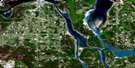
Ile Parisienne Satellite Imagery
To view this satellite map, mouse over the air photo on the right.
You can also download this satellite image map for free:
041K10 Ile Parisienne high-resolution satellite image map.
Maps for the Ile Parisienne aerial map sheet 041K10 at 1:50,000 scale are also available in these versions:
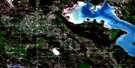
Ile Parisienne Surrounding Area Aerial Photo Maps
 |
 |
||
 |
 |
||
 |
|||
 |
© Department of Natural Resources Canada. All rights reserved.
Ile Parisienne Gazetteer
The following places can be found on satellite image map 041K10 Ile Parisienne:
Ile Parisienne Satellite Image: Bays
Goulais BayHorseshoe Harbour
Sand Bay
Whitefish Bay
Ile Parisienne Satellite Image: Capes
Goulais PointGros Cap
North Gros Cap
Ile Parisienne Satellite Image: City
Sault Ste. MarieIle Parisienne Satellite Image: Geographical areas
AlgomaDennis
Kars
Parke
Prince
Ile Parisienne Satellite Image: Indian Reserves
Goulais Bay 15AGoulais Bay Indian Reserve 15A
Réserve indienne Goulais Bay 15A
Ile Parisienne Satellite Image: Islands
Chêne IslandIle Parisienne
Jackson Island
Ile Parisienne Satellite Image: Lakes
Lac SupérieurLake Superior
Prince Lake
Walls Lake
Ile Parisienne Satellite Image: Other municipal/district area - miscellaneous
PrinceIle Parisienne Satellite Image: Conservation areas
Ile Parisienne Conservation ReserveIle Parisienne Satellite Image: Rivers
Big Carp RiverPrince Creek
Rivière Ste-Marie
St. Mary River
St. Marys River
Ile Parisienne Satellite Image: Shoals
Gros Cap ReefsParisienne Shoal
Ile Parisienne Satellite Image: Unincorporated areas
Goulais MissionGros Cap
Pointe des Chênes Park
Red Rock
Sand Bay

© Department of Natural Resources Canada. All rights reserved.
