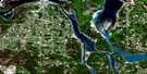
Sault Ste Marie Satellite Image Map
Download Free Aerial Photo 041K09 at 1:50,000 scale
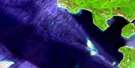
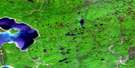
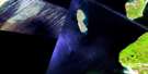
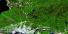
Sault Ste Marie Satellite Imagery
To view this satellite map, mouse over the air photo on the right.
You can also download this satellite image map for free:
041K09 Sault Ste Marie high-resolution satellite image map.
Maps for the Sault Ste Marie aerial map sheet 041K09 at 1:50,000 scale are also available in these versions:
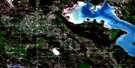
Sault Ste Marie Surrounding Area Aerial Photo Maps
 |
 |
||
 |
 |
||
 |
|||
 |
© Department of Natural Resources Canada. All rights reserved.
Sault Ste Marie Gazetteer
The following places can be found on satellite image map 041K09 Sault Ste Marie:
Sault Ste Marie Satellite Image: Bays
Echo BayGoulais Bay
Leigh Bay
Marks Bay
Sault Ste Marie Satellite Image: Beaches
Sand BeachSault Ste Marie Satellite Image: Capes
Bell PointBell's Point
Fenwick Point
Maple Point
Old Vessel Point
Partridge Point
Point Charles
Stony Point
Sault Ste Marie Satellite Image: Channels
North ChannelSault Ste Marie Satellite Image: City
Sault Ste. MarieSault Ste Marie Satellite Image: Cliffs
High DumpTrap Rock
Sault Ste Marie Satellite Image: Falls
Beaver FallsCrystal Falls
Minnehaha Falls
Sault Ste Marie Satellite Image: Geographical areas
AlgomaAnderson
Awenge
Aweres
Dennis
Deroche
Duncan
Fenwick
Hodgins
Jarvis
Kehoe
Korah
Macdonald
Parke
Pennefather
Prince
Tarentorus
VanKoughnet
Sault Ste Marie Satellite Image: Indian Reserves
Garden River 14Garden River Indian Reserve 14
Rankin Location 15D
Rankin Location Indian Reserve 15D
Réserve indienne Garden River 14
Réserve indienne Rankin Location 15D
Réserve indienne Whitefish Island
Whitefish Island
Whitefish Island Indian Reserve
Sault Ste Marie Satellite Image: Islands
Baschine IslandCook Island
Dick Moore Island
Sand Island
Shingwauk Island
Squirrel Island
St. Mary's Island
Topsail Island
Whitefish Island
Young Island
Sault Ste Marie Satellite Image: Lakes
Alexander LakeAllard Lake
Anderson Lake
Ann Lake
Aweres Lake
Belleau Lake
Bob Chips Lake
Boss Lake
Boundary Lake
Brilliant Lake
Caribou Lake
Christman Lake
Chub Lake
Clearwater Lake
Crooked Lakes
Crystal Lake
Dead Horse Lake
DeGraff Lake
Driving Lake
Echo Lake
Elizabeth Lake
Fillion Lake
Finn Lake
Gordon Lake
Grassy Lake
Herbert Lake
Heyden Lake
Heyden Lakes
Jarvis Lake
Johnson Lake
Kaufman Lake
Kelly Lake
Lac Supérieur
Lake George
Lake One
Lake Superior
Legge Lake
Lilypad Lake
Little Lake George
Lower Island Lake
Lynch Lake
Mabel Lake
Maki Lake
Maple Lake
Maud Lake
McIntyre Lake
Meniss Lake
Midge Lake
Moss Lake
Nettleton Lake
Northland Lake
Owl Lake
Paddy Lake
Pants Lake
Phelbin Lake
Quinn Lake
Rainbow Lake
Redrock Lake
Reserve Lake
Sandy Lake
St. Joe Lake
Surette Lake
Syrette Lake
Trotter Lake
Trout Lake
Upper Island Lake
Wahbunose Lake
Weashkog Lake
White Birch Lake
Wigwas Lake
Sault Ste Marie Satellite Image: Military areas
Champ de manoeuvre KorahKorah Training Area
Sault Ste Marie Satellite Image: Mountains
Clay HillKaboosa Hill
Maple Ridge
Sand Hill
Sault Ste Marie Satellite Image: Other municipal/district area - miscellaneous
KorahMacdonald, Meredith and Aberdeen Additional
Prince
Tarentorus
Sault Ste Marie Satellite Image: Conservation areas
Goulais River Beach Ridges Conservation ReserveLieu historique national du Canada du Canal-de-Sault Ste. Marie
Sault Ste. Marie Canal National Historic Site of Canada
Searchmont South Forest Conservation Reserve
Sault Ste Marie Satellite Image: Plains
Gogwabik FlatsThe High Dump
Sault Ste Marie Satellite Image: Rapids
Murphys RapidsMurphy's Rapids
The Rapids
Sault Ste Marie Satellite Image: Rivers
Bar CreekBedore Creek
Bellevue Creek
Bennet Creek
Bennett Creek
Big Carp River
Clark Creek
Coldwater Creek
Cranberry Creek
Crystal Creek
Dam Creek
Dead Horse Creek
Driving Creek
East Davignon Creek
Echo River
Elm Creek
Fort Creek
Garden River
Goulais River
Kelly Creek
Lamon Creek
Leishman Creek
Little Carp River
Lower Echo River
Maple Creek
Maud Creek
Mill Creek
Northland Creek
Rainbow Creek
Rivière Ste-Marie
Robertson Creek
Root River
Sheppard Creek
Silver Creek
South Channel
Spring Creek
St. Mary River
St. Marys River
Stony Creek
Taylor Creek
Thielman Creek
West Davignon Creek
West Root River
Sault Ste Marie Satellite Image: River features
The Big BendSault Ste Marie Satellite Image: Shoals
Vidal ShoalsSault Ste Marie Satellite Image: Unincorporated areas
BayviewBellevue
Bellevue Station
Bourdages Corner
Broadview Gardens
Brookfield
Buckley
Carpin Beach
Cedar Heights
East Korah
Eastside
Echo River
Fort Creek
French Bay
Garden River
Glendale
Goulais Bay
Goulais River
Grandview Gardens
Heyden
Huckson Corners
Island Lake
Kirby's Corner
Korah
Manitou Park
McQueen
Meadow Park
Northland
Odena
Sault Ship Canal
Steelton
Steelton
The P Patch
Sault Ste Marie Satellite Image: Valleys
Bellevue Valley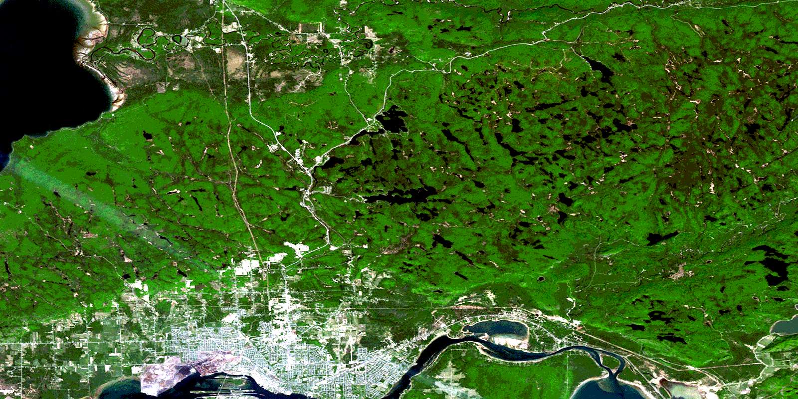
© Department of Natural Resources Canada. All rights reserved.
