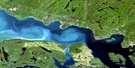
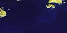
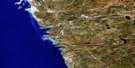
Otter Island Satellite Image Map
Download Free Aerial Photo 042D01 at 1:50,000 scale
Otter Island Satellite Imagery
To view this satellite map, mouse over the air photo on the right.
You can also download this satellite image map for free:
042D01 Otter Island high-resolution satellite image map.
Maps for the Otter Island aerial map sheet 042D01 at 1:50,000 scale are also available in these versions:
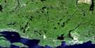
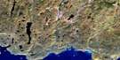
Otter Island Surrounding Area Aerial Photo Maps
 |
 |
 |
 |
 |
 |
 |
 |
 |
|||
 |
© Department of Natural Resources Canada. All rights reserved.
Otter Island Gazetteer
The following places can be found on satellite image map 042D01 Otter Island:
Otter Island Satellite Image: Bays
Deep HarbourEnglish Fishery Harbour
Newman's Bay
Old Daves Harbour
Otter Cove
Trapper Harbour
Triangle Harbour
Otter Island Satellite Image: Capes
Otter HeadOtter Island Satellite Image: Falls
Cascade FallsOtter Island Satellite Image: Geographical areas
ByronHomer
Thunder Bay
Otter Island Satellite Image: Islands
Otter IslandWeidman's Island
Otter Island Satellite Image: Lakes
Berkstrom LakeBuchanan Lake
Grandma Stevens Pond
Hideaway Lake
Lac Supérieur
Lake Superior
Perry Lake
Scapula Lake
Steeres Lake
Sund Lake
Otter Island Satellite Image: Conservation areas
Parc national du Canada PukaskwaPukaskwa National Park of Canada
Otter Island Satellite Image: Rivers
Cascade RiverNorth Swallow River
North Swallow River
Swallow River
Swallow River

© Department of Natural Resources Canada. All rights reserved.
