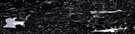
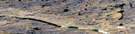
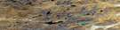
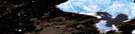
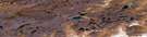
Becher River Satellite Image Map
Download Free Aerial Photo 057A11 at 1:50,000 scale
Becher River Satellite Imagery
To view this satellite map, mouse over the air photo on the right.
You can also download this satellite image map for free:
057A11 Becher River high-resolution satellite image map.
Maps for the Becher River aerial map sheet 057A11 at 1:50,000 scale are also available in these versions:
Becher River Surrounding Area Aerial Photo Maps
 |
 |
 |
 |
 |
 |
 |
 |
 |
 |
 |
 |
 |
 |
 |
 |
© Department of Natural Resources Canada. All rights reserved.
Becher River Gazetteer
The following places can be found on satellite image map 057A11 Becher River:
Becher River Satellite Image: Bays
Gulf of BoothiaPelly Bay
Ujarasugjuaraarjuk Bay
Becher River Satellite Image: Capes
Ikaaqtalik PointBecher River Satellite Image: Islands
Akuliarut IslandHelen Island
Irniturniq Island
Pullagaarjuk Island
Pullat Island
Qikiqtak Islands
Qimivvik Island
Qirliaqtuq Island
Tuapagiktuq Island
Ujaraqtuunnuaq Island
Becher River Satellite Image: Lakes
Tahilugjuaq LakeTahirarjuaq Lake
Becher River Satellite Image: Rivers
Becher RiverKuugarjuaraarjuk River
Tinuujsaaq River
Tinuuqjaajuk River
© Department of Natural Resources Canada. All rights reserved.
057A Related Maps:
057A Pelly Bay057A01 Mount Mactavish
057A02 Cameron Lake
057A03 No Title
057A04 No Title
057A05 No Title
057A06 De Stael Point
057A07 Barrow Lake
057A08 Keith Bay
057A09 No Title
057A10 Login Bay
057A11 Becher River
057A12 Euphemia Hill
057A13 Burwash Lake
057A14 No Title
057A15 No Title
057A16 No Title
