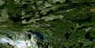
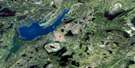
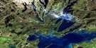
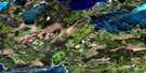
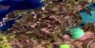
Elbow Lake Satellite Image Map
Download Free Aerial Photo 063K15 at 1:50,000 scale
Elbow Lake Satellite Imagery
To view this satellite map, mouse over the air photo on the right.
You can also download this satellite image map for free:
063K15 Elbow Lake high-resolution satellite image map.
Maps for the Elbow Lake aerial map sheet 063K15 at 1:50,000 scale are also available in these versions:
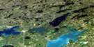
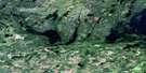
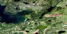
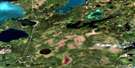
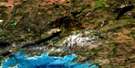
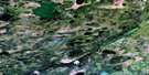
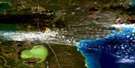
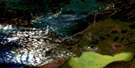
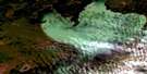
Elbow Lake Surrounding Area Aerial Photo Maps
 |
 |
 |
 |
 |
 |
 |
 |
 |
 |
 |
 |
 |
 |
 |
 |
© Department of Natural Resources Canada. All rights reserved.
Elbow Lake Gazetteer
The following places can be found on satellite image map 063K15 Elbow Lake:
Elbow Lake Satellite Image: Bays
Claw BayLong Bay
Moen Bay
Elbow Lake Satellite Image: Capes
McDougalls PointElbow Lake Satellite Image: Islands
Big Poplar IslandChinaman Island
Gold Dust Island
Hanna Islands
Larsen Island
Larson Island
Nelsons Island
Smith Island
Webb Island
Elbow Lake Satellite Image: Lakes
Big Rat LakeCabin Lake
Carter Lake
Centre Lake
Claw Lake
Dow Lake
Drury Lakes
Echo Lake
Elbow Lake
Eriksons Lake
Gants Lake
Gauthier Lake
Hasset Lake
Hootenany Lake
King Lake
Koscielny Lake
Krug Lake
LaBell Lake
Little Claw Lake
Little Long Lake
Little Swan Lake
Long Lake
Loonhead Lake
Marie Lake
Martell Lake
Muhekun Lake
Norris Lake
North Star Lake
Peloquin Lake
Preaston Lake
Prieston Lake
Rail Lake
Robertsons Lake
Sewell Lake
Sexton Lake
Spider Lake
Stolberg Lake
Storozuk Lake
Sulphide Lake
Tee Lake
Webb Lake
Elbow Lake Satellite Image: Conservation areas
Grass River Provincial ParkElbow Lake Satellite Image: Rapids
Mill RapidsElbow Lake Satellite Image: Rivers
File RiverGrass River
Separation Creek
Webb Creek

© Department of Natural Resources Canada. All rights reserved.
063K Related Maps:
063K Cormorant Lake063K01 Burntwood Bay
063K02 Cormorant
063K03 Root Lake
063K04 Namew Lake
063K05 Goose Lake
063K06 Egg Lake
063K07 Yawningstone Lake
063K08 Dyce Lake
063K09 Tramping Lake
063K10 Iskwasum Lake
063K11 Cranberry Portage
063K12 Schist Lake
063K13 Flin Flon
063K14 Naosap Lake
063K15 Elbow Lake
063K16 File Lake
