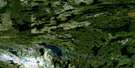
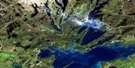
Goose Lake Satellite Image Map
Download Free Aerial Photo 063K05 at 1:50,000 scale
Goose Lake Satellite Imagery
To view this satellite map, mouse over the air photo on the right.
You can also download this satellite image map for free:
063K05 Goose Lake high-resolution satellite image map.
Maps for the Goose Lake aerial map sheet 063K05 at 1:50,000 scale are also available in these versions:
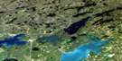
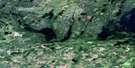
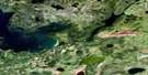
Goose Lake Surrounding Area Aerial Photo Maps
 |
 |
 |
 |
 |
 |
 |
 |
 |
 |
 |
 |
 |
 |
 |
 |
© Department of Natural Resources Canada. All rights reserved.
Goose Lake Gazetteer
The following places can be found on satellite image map 063K05 Goose Lake:
Goose Lake Satellite Image: Bays
Camp Two BayMedrick Bay
Newland Bay
South Bay
Goose Lake Satellite Image: Hamlets
Sturgeon LandingGoose Lake Satellite Image: Indian Reserves
Sturgeon Weir 184FSturgeon Weir 205
Goose Lake Satellite Image: Islands
Niska IslandGoose Lake Satellite Image: Lakes
Athapapuskow LakeBarbe Lake
Chocolate Lake
Egg Lake
Goldthorpe Lake
Goose Lake
Maraiche Lake
Moller Lake
Namew Lake
Namew Lake
Nepe (Leaf) Lake
Saskoba Lake
Saskoba Lake
Yarush Lake
Goose Lake Satellite Image: Rapids
Niska RapidsTwo Mile Rapids
Goose Lake Satellite Image: Rivers
Goose RiverGoose River
Sturgeon-weir River
Goose Lake Satellite Image: Road features
Athapap RoadNamew Lake Road
Goose Lake Satellite Image: Low vegetation
Ess Slough
© Department of Natural Resources Canada. All rights reserved.
063K Related Maps:
063K Cormorant Lake063K01 Burntwood Bay
063K02 Cormorant
063K03 Root Lake
063K04 Namew Lake
063K05 Goose Lake
063K06 Egg Lake
063K07 Yawningstone Lake
063K08 Dyce Lake
063K09 Tramping Lake
063K10 Iskwasum Lake
063K11 Cranberry Portage
063K12 Schist Lake
063K13 Flin Flon
063K14 Naosap Lake
063K15 Elbow Lake
063K16 File Lake
