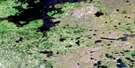
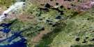
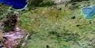
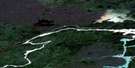
Crying Lake Satellite Image Map
Download Free Aerial Photo 064A08 at 1:50,000 scale
Crying Lake Satellite Imagery
To view this satellite map, mouse over the air photo on the right.
You can also download this satellite image map for free:
064A08 Crying Lake high-resolution satellite image map.
Maps for the Crying Lake aerial map sheet 064A08 at 1:50,000 scale are also available in these versions:
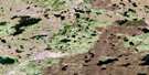
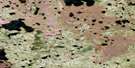
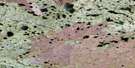
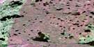
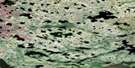
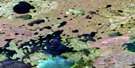
Crying Lake Surrounding Area Aerial Photo Maps
 |
 |
 |
 |
 |
 |
 |
 |
 |
 |
 |
 |
 |
 |
 |
 |
© Department of Natural Resources Canada. All rights reserved.
Crying Lake Gazetteer
The following places can be found on satellite image map 064A08 Crying Lake:
Crying Lake Satellite Image: Bays
Iskwayach BayKeskapiskow Bay
Crying Lake Satellite Image: Capes
Payuknepitnayak PointCrying Lake Satellite Image: Channels
Awupak NarrowsCrying Lake Satellite Image: Indian Reserves
Split Lake 171Crying Lake Satellite Image: Lakes
Akechepeemaywasik LakeAministikowaw Lake
Anesookamasik Lakes
Apetowachakamasik Lake
Asitayatik Lake
Assean Lake
Awanakenasik Lake
Awapawakasik Lake
Awuskwiwasik Lake
Crooked Lake
Crying Lake
Fox Lake
Koskohoe Lake
Little Assean Lake
Onawaykopawin Lake
Pukituwaw Lake
Split Lake
Waskaiowaka Lake
Waweyayaw Lake
Wuchusk Lake
Crying Lake Satellite Image: Rivers
Apetow RiverApukeetawacheekatak Creek
Assean River
Awaweyaykamak Creek
Crying River
Fleuve Nelson
Hunting River
Nelson River
Crying Lake Satellite Image: Road features
Apeschaw Portage
© Department of Natural Resources Canada. All rights reserved.
064A Related Maps:
064A Split Lake064A01 Split Lake
064A02 Assean Lake
064A03 Orr Lake
064A04 Strong Lake
064A05 Warnews River
064A06 Meridian Lake
064A07 Pelletier Lake
064A08 Crying Lake
064A09 Hale Lake
064A10 Caldwell Lake
064A11 Campbell Lake
064A12 Jensen Lake
064A13 Gauer Lake
064A14 Wernham Lake
064A15 Christie Lake
064A16 Bieber River
