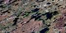
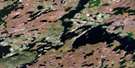
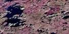
Stevens Lake Satellite Image Map
Download Free Aerial Photo 064K16 at 1:50,000 scale
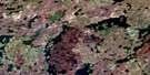
Stevens Lake Satellite Imagery
To view this satellite map, mouse over the air photo on the right.
You can also download this satellite image map for free:
064K16 Stevens Lake high-resolution satellite image map.
Maps for the Stevens Lake aerial map sheet 064K16 at 1:50,000 scale are also available in these versions:
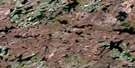
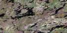
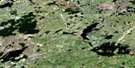
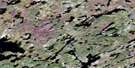
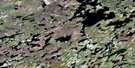
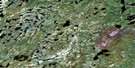
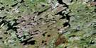
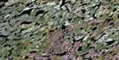
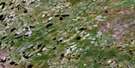
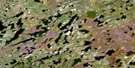
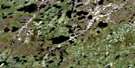
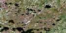
Stevens Lake Surrounding Area Aerial Photo Maps
 |
 |
 |
 |
 |
 |
 |
 |
 |
 |
 |
 |
 |
 |
 |
 |
© Department of Natural Resources Canada. All rights reserved.
Stevens Lake Gazetteer
The following places can be found on satellite image map 064K16 Stevens Lake:
Stevens Lake Satellite Image: Bays
Andrews BayFrancis Bay
Gardner Bay
Kapakeeskwak Bay
Lee Bay
Love Bay
Vincent Bay
Stevens Lake Satellite Image: Capes
Carriere PointFisher Point
Gold Point
Gray Peninsula
Harper Point
Tod Point
Stevens Lake Satellite Image: Islands
Dowland IslandGlover Island
Gold Island
Stubbs Island
Stevens Lake Satellite Image: Lakes
Akwakosakumin LakeApeecheekamow Lake
Burnie Lake
Caron Lake
Dean Lake
Dillabough Lake
Egenolf Lake
Firman Lake
Haigh Lake
Hourie Lake
Keewatinkinokumaw Lake
Krahn Lake
Kuzina Lake
Kwiatkowski Lake
Magas Lake
Magas Lake
Reske Lake
Stevens Lake
Stevens Lake Satellite Image: Mountains
Arthur Smith HillRobertson Esker
Wood Hill
Stevens Lake Satellite Image: Rivers
Laurila RiverNorth Seal River

© Department of Natural Resources Canada. All rights reserved.
064K Related Maps:
064K Whiskey Jack Lake064K01 Chartrand Lake
064K02 Ducharme Lake
064K03 Easton Lake
064K04 Engen Lake
064K05 Whiskey Jack Lake
064K06 Fagnan Lake
064K07 Morrow Lake
064K08 Dechief Lake
064K09 Pangman Lake
064K10 Paulson Lake
064K11 Chipewyan Falls
064K12 Lac Brochet
064K13 Misty Lake
064K14 Rutledge Lake
064K15 Chatwin Lake
064K16 Stevens Lake
