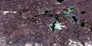
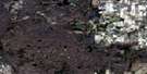
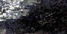
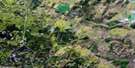
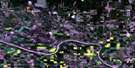
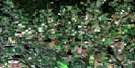
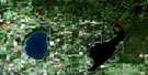
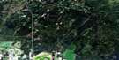
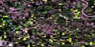
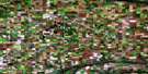
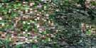
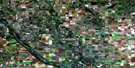
Medstead Satellite Image Map
Download Free Aerial Photo 073F08 at 1:50,000 scale
Medstead Satellite Imagery
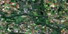
To view this satellite map, mouse over the air photo on the right.
You can also download this satellite image map for free:
073F08 Medstead high-resolution satellite image map.
Maps for the Medstead aerial map sheet 073F08 at 1:50,000 scale are also available in these versions:
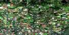
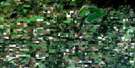
Medstead Surrounding Area Aerial Photo Maps
 |
 |
 |
 |
 |
 |
 |
 |
 |
 |
 |
 |
 |
 |
 |
 |
© Department of Natural Resources Canada. All rights reserved.
Medstead Gazetteer
The following places can be found on satellite image map 073F08 Medstead:
Medstead Satellite Image: Bays
Settee BaySpence Bay
Young Bay
Medstead Satellite Image: Indian Reserves
Moosomin 112GSaulteaux 159A
Saulteaux 159C
Saulteaux 159D
Saulteaux 159G
Saulteaux 159J
Saulteaux 159K
Saulteaux 159L
Saulteaux 159N
Saulteaux 159S
Saulteaux 159T
Saulteaux 159V
Saulteaux 159Y
Saulteaux First Nation 159BB
Medstead Satellite Image: Lakes
Birch LakeBroughton Lake
Bruce Lakes
Curry Lake
Curry Lakes
Helene Lake
Hoodoo Lake
Klein Lake
Little Loon Lake
Macleod Lake
Maiden Lake
Mark Lake
Michnik Lake
Midnight Lake
Sibbald Lake
Medstead Satellite Image: Other municipal/district area - miscellaneous
Medstead No. 497Parkdale No. 498
Medstead Satellite Image: Conservation areas
Little Loon Lake Regional ParkNorthern Provincial Forest
Medstead Satellite Image: Rivers
Dewan CreekJackfish Creek
Lost Horse Creek
Robinson Creek
Medstead Satellite Image: Unincorporated areas
Birch LakeBirkensee
Cater
East Anglia
Glenbush
Helena Lake
Junor
Marlin
Midnight Lake
Robinhood
Medstead Satellite Image: Villages
GlaslynMedstead

© Department of Natural Resources Canada. All rights reserved.
073F Related Maps:
073F St Walburg073F01 Jackfish Lake
073F02 Edam
073F03 Maidstone
073F04 Lashburn
073F05 Greenstreet
073F06 Cleeves
073F07 Turtleford
073F08 Medstead
073F09 Helene Lake
073F10 Brightsand Lake
073F11 St Walburg
073F12 Frenchman Butte
073F13 Bronson Lake
073F14 Barthel
073F15 Horsehead Creek
073F16 Hunting Lake
