Pachena Point Satellite Image Map
Download Free Aerial Photo 092C11 at 1:50,000 scale
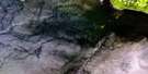
Pachena Point Satellite Imagery
To view this satellite map, mouse over the air photo on the right.
You can also download this satellite image map for free:
092C11 Pachena Point high-resolution satellite image map.
Maps for the Pachena Point aerial map sheet 092C11 at 1:50,000 scale are also available in these versions:
Pachena Point Surrounding Area Aerial Photo Maps
 |
 |
 |
 |
 |
 |
 |
|
 |
|||
© Department of Natural Resources Canada. All rights reserved.
Pachena Point Gazetteer
The following places can be found on satellite image map 092C11 Pachena Point:
Pachena Point Satellite Image: Capes
Pachena PointPachena Point Satellite Image: Indian Reserves
Masit Indian Reserve 13Réserve indienne Masit 13
Pachena Point Satellite Image: Islands
Île de VancouverVancouver Island
Pachena Point Satellite Image: Mountains
Somerset RangeVancouver Island Ranges
Pachena Point Satellite Image: Major municipal/district area - major agglomerations
Regional District of Alberni-ClayoquotPachena Point Satellite Image: Conservation areas
Pacific Rim National Park Reserve of CanadaRéserve de parc national du Canada Pacific Rim
Pachena Point Satellite Image: Rivers
Billy Goat CreekBlack River
Darling River
Hegstrom Creek
Malthsit
Michigan Creek
Orange Juice Creek
Tsocowis Creek
Pachena Point Satellite Image: Road features
West Coast TrailPachena Point Satellite Image: Shoals
Seabird RocksSoquel Bank

© Department of Natural Resources Canada. All rights reserved.
