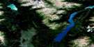
Scud River Satellite Image Map
Download Free Aerial Photo 104G05 at 1:50,000 scale
Scud River Satellite Imagery
To view this satellite map, mouse over the air photo on the right.
You can also download this satellite image map for free:
104G05 Scud River high-resolution satellite image map.
Maps for the Scud River aerial map sheet 104G05 at 1:50,000 scale are also available in these versions:
Scud River Surrounding Area Aerial Photo Maps
 |
 |
 |
 |
 |
 |
 |
 |
 |
 |
 |
 |
 |
 |
 |
 |
© Department of Natural Resources Canada. All rights reserved.
Scud River Gazetteer
The following places can be found on satellite image map 104G05 Scud River:
Scud River Satellite Image: Lakes
Butterfly LakeScud River Satellite Image: Mountains
Boundary RangesButterfly Mountain
Cirque Mountain
Coast Mountains
Commander Mountain
Cone Mountain
Donnaker Mountain
Endeavour Mountain
Geology Ridge
Hamper Mountain
Mount Donnaker
Mount Jonquette
Oksa Mountain
Phacops Mountain
Recumbent Mountain
Scud River Satellite Image: Major municipal/district area - major agglomerations
Regional District of Kitimat-StikineScud River Satellite Image: Rivers
Brydon CreekButterfly Creek
Christina Creek
Contact Creek
Deeker Creek
Devils Club Creek
Dokdaon Creek
Donnaker Creek
Elwyn Creek
Fishbone Creek
Jonquette Creek
Navo Creek
Oksa Creek
Oksa River
Patmore Creek
Scud River
Stikine River
Scud River Satellite Image: Road features
Scud PortageScud River Satellite Image: Valleys
Little Canyon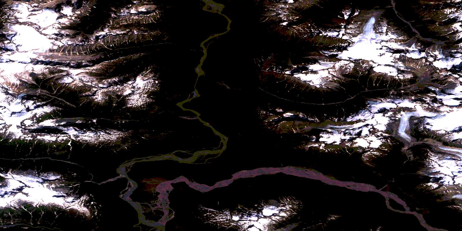
© Department of Natural Resources Canada. All rights reserved.
104G Related Maps:
104G Telegraph Creek104G01 Iskut River
104G02 More Creek
104G03 Sphaler Creek
104G04 Flood Glacier
104G05 Scud River
104G06 Scud Glacier
104G07 Mess Lake
104G08 Refuge Lake
104G09E Kinaskan Lake
104G09W Kinaskan Lake
104G10 Mount Edziza
104G11 Yehiniko Lake
104G12 Chutine River
104G13 Tahltan Lake
104G14E Telegraph Creek
104G14W Telegraph Creek
104G15E Buckley Lake
104G15W Buckley Lake
104G16E Klastline River
104G16W Klastline River
